M04C Macdoel, CA, USA - Earthquake Result Viewer
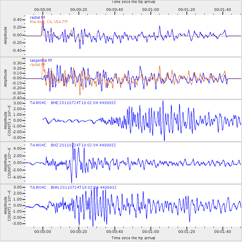
Earthquake location: Near East Coast Of Honshu, Japan
Earthquake latitude/longitude: 37.7/141.4
Earthquake time(UTC): 2011/07/24 (205) 18:51:24 GMT
Earthquake Depth: 35 km
Earthquake Magnitude: 6.3 MB, 5.9 MS, 6.3 MW, 6.3 MW
Earthquake Catalog/Contributor: WHDF/NEIC
Network: TA USArray Transportable Network (new EarthScope stations)
Station: M04C Macdoel, CA, USA
Lat/Lon: 41.78 N/121.84 W
Elevation: 1391 m
Distance: 70.5 deg
Az: 52.01 deg
Baz: 303.326 deg
Ray Param: 0.054919492
Estimated Moho Depth: 39.25 km
Estimated Crust Vp/Vs: 1.78
Assumed Crust Vp: 6.566 km/s
Estimated Crust Vs: 3.684 km/s
Estimated Crust Poisson's Ratio: 0.27
Radial Match: 81.40538 %
Radial Bump: 400
Transverse Match: 86.76298 %
Transverse Bump: 400
SOD ConfigId: 405110
Insert Time: 2011-12-29 05:50:49.378 +0000
GWidth: 2.5
Max Bumps: 400
Tol: 0.001

Signal To Noise

ChannelStoNSTALTA
TA:M04C: :BHZ:20110724T19:02:04.449993Z2.92855865.134135E-71.753127E-7
TA:M04C: :BHN:20110724T19:02:04.449993Z1.41479063.9072617E-72.7617241E-7
TA:M04C: :BHE:20110724T19:02:04.449993Z1.2045532.3336516E-71.937359E-7
Arrivals
Ps4.9 SECOND
PpPs16 SECOND
PsPs/PpSs21 SECOND