Q24A Divide, CO, USA - Earthquake Result Viewer
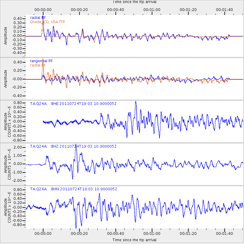
Earthquake location: Near East Coast Of Honshu, Japan
Earthquake latitude/longitude: 37.7/141.4
Earthquake time(UTC): 2011/07/24 (205) 18:51:24 GMT
Earthquake Depth: 35 km
Earthquake Magnitude: 6.3 MB, 5.9 MS, 6.3 MW, 6.3 MW
Earthquake Catalog/Contributor: WHDF/NEIC
Network: TA USArray Transportable Network (new EarthScope stations)
Station: Q24A Divide, CO, USA
Lat/Lon: 38.96 N/105.15 W
Elevation: 2775 m
Distance: 82.2 deg
Az: 46.206 deg
Baz: 312.763 deg
Ray Param: 0.046997406
Estimated Moho Depth: 51.5 km
Estimated Crust Vp/Vs: 1.69
Assumed Crust Vp: 6.159 km/s
Estimated Crust Vs: 3.655 km/s
Estimated Crust Poisson's Ratio: 0.23
Radial Match: 86.29238 %
Radial Bump: 400
Transverse Match: 73.62152 %
Transverse Bump: 400
SOD ConfigId: 405110
Insert Time: 2011-12-29 05:52:03.993 +0000
GWidth: 2.5
Max Bumps: 400
Tol: 0.001

Signal To Noise

ChannelStoNSTALTA
TA:Q24A: :BHZ:20110724T19:03:10.900005Z6.13641264.795385E-77.814639E-8
TA:Q24A: :BHN:20110724T19:03:10.900005Z2.69901921.5670196E-75.805885E-8
TA:Q24A: :BHE:20110724T19:03:10.900005Z2.64614631.5351132E-75.8013164E-8
Arrivals
Ps5.9 SECOND
PpPs22 SECOND
PsPs/PpSs28 SECOND