J30A Dallas, SD, USA - Earthquake Result Viewer
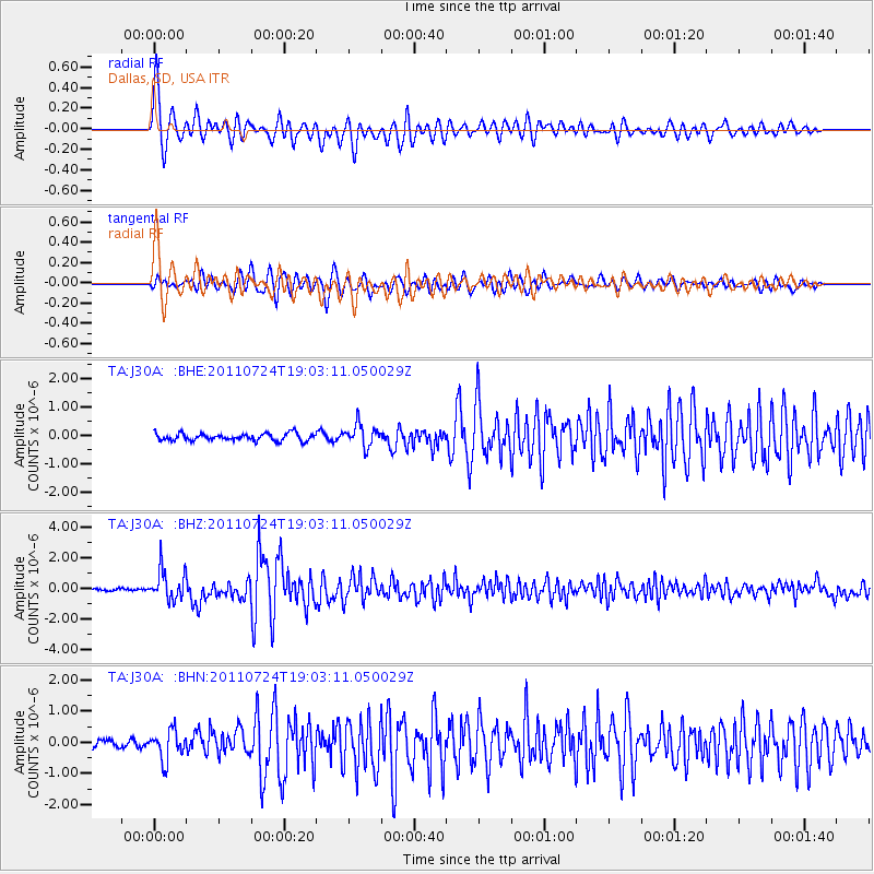
Earthquake location: Near East Coast Of Honshu, Japan
Earthquake latitude/longitude: 37.7/141.4
Earthquake time(UTC): 2011/07/24 (205) 18:51:24 GMT
Earthquake Depth: 35 km
Earthquake Magnitude: 6.3 MB, 5.9 MS, 6.3 MW, 6.3 MW
Earthquake Catalog/Contributor: WHDF/NEIC
Network: TA USArray Transportable Network (new EarthScope stations)
Station: J30A Dallas, SD, USA
Lat/Lon: 43.32 N/99.49 W
Elevation: 608 m
Distance: 82.2 deg
Az: 40.051 deg
Baz: 315.642 deg
Ray Param: 0.04697765
Estimated Moho Depth: 43.75 km
Estimated Crust Vp/Vs: 1.96
Assumed Crust Vp: 6.53 km/s
Estimated Crust Vs: 3.332 km/s
Estimated Crust Poisson's Ratio: 0.32
Radial Match: 93.53423 %
Radial Bump: 400
Transverse Match: 87.35766 %
Transverse Bump: 400
SOD ConfigId: 405110
Insert Time: 2011-12-29 05:53:54.252 +0000
GWidth: 2.5
Max Bumps: 400
Tol: 0.001

Signal To Noise

ChannelStoNSTALTA
TA:J30A: :BHZ:20110724T19:03:11.050029Z12.9229979.898099E-77.6592904E-8
TA:J30A: :BHN:20110724T19:03:11.050029Z4.48408754.6177516E-71.0298085E-7
TA:J30A: :BHE:20110724T19:03:11.050029Z2.9764933.803864E-71.2779684E-7
Arrivals
Ps6.6 SECOND
PpPs19 SECOND
PsPs/PpSs26 SECOND