K30A Basset, NE, USA - Earthquake Result Viewer
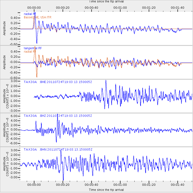
Earthquake location: Near East Coast Of Honshu, Japan
Earthquake latitude/longitude: 37.7/141.4
Earthquake time(UTC): 2011/07/24 (205) 18:51:24 GMT
Earthquake Depth: 35 km
Earthquake Magnitude: 6.3 MB, 5.9 MS, 6.3 MW, 6.3 MW
Earthquake Catalog/Contributor: WHDF/NEIC
Network: TA USArray Transportable Network (new EarthScope stations)
Station: K30A Basset, NE, USA
Lat/Lon: 42.67 N/99.61 W
Elevation: 712 m
Distance: 82.6 deg
Az: 40.573 deg
Baz: 315.628 deg
Ray Param: 0.04669836
Estimated Moho Depth: 10.0 km
Estimated Crust Vp/Vs: 1.60
Assumed Crust Vp: 6.53 km/s
Estimated Crust Vs: 4.082 km/s
Estimated Crust Poisson's Ratio: 0.18
Radial Match: 91.813095 %
Radial Bump: 400
Transverse Match: 87.4467 %
Transverse Bump: 400
SOD ConfigId: 405110
Insert Time: 2011-12-29 05:54:06.804 +0000
GWidth: 2.5
Max Bumps: 400
Tol: 0.001

Signal To Noise

ChannelStoNSTALTA
TA:K30A: :BHZ:20110724T19:03:13.150005Z11.0810671.1210478E-61.01167856E-7
TA:K30A: :BHN:20110724T19:03:13.150005Z2.92531944.941266E-71.6891373E-7
TA:K30A: :BHE:20110724T19:03:13.150005Z2.62669134.5721677E-71.7406566E-7
Arrivals
Ps0.9 SECOND
PpPs3.9 SECOND
PsPs/PpSs4.8 SECOND