534A Blanco, TX, USA - Earthquake Result Viewer
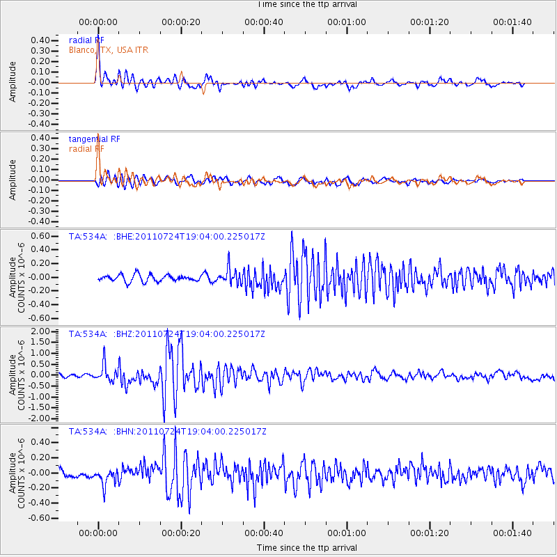
Earthquake location: Near East Coast Of Honshu, Japan
Earthquake latitude/longitude: 37.7/141.4
Earthquake time(UTC): 2011/07/24 (205) 18:51:24 GMT
Earthquake Depth: 35 km
Earthquake Magnitude: 6.3 MB, 5.9 MS, 6.3 MW, 6.3 MW
Earthquake Catalog/Contributor: WHDF/NEIC
Network: TA USArray Transportable Network (new EarthScope stations)
Station: 534A Blanco, TX, USA
Lat/Lon: 30.03 N/98.48 W
Elevation: 461 m
Distance: 92.4 deg
Az: 48.652 deg
Baz: 316.656 deg
Ray Param: 0.041455045
Estimated Moho Depth: 45.25 km
Estimated Crust Vp/Vs: 1.72
Assumed Crust Vp: 6.498 km/s
Estimated Crust Vs: 3.778 km/s
Estimated Crust Poisson's Ratio: 0.24
Radial Match: 93.046135 %
Radial Bump: 400
Transverse Match: 79.66607 %
Transverse Bump: 400
SOD ConfigId: 405110
Insert Time: 2011-12-29 05:56:41.087 +0000
GWidth: 2.5
Max Bumps: 400
Tol: 0.001

Signal To Noise

ChannelStoNSTALTA
TA:534A: :BHZ:20110724T19:04:00.225017Z4.88366133.9902164E-78.170543E-8
TA:534A: :BHN:20110724T19:04:00.225017Z3.07047961.1907124E-73.8779362E-8
TA:534A: :BHE:20110724T19:04:00.225017Z2.38668231.15321356E-74.831869E-8
Arrivals
Ps5.1 SECOND
PpPs19 SECOND
PsPs/PpSs24 SECOND