334A Lometa, TX, USA - Earthquake Result Viewer
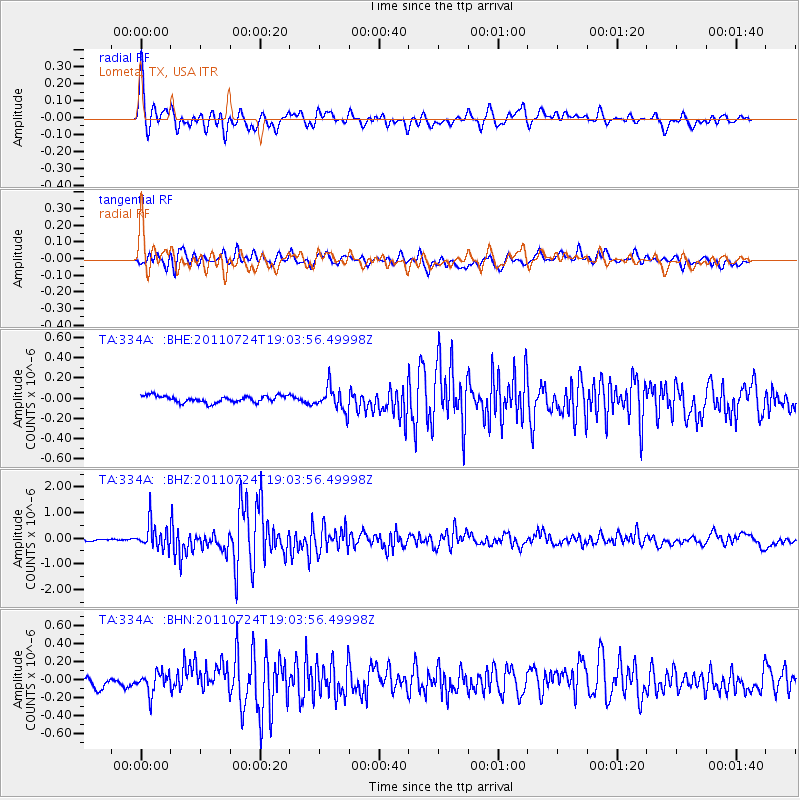
Earthquake location: Near East Coast Of Honshu, Japan
Earthquake latitude/longitude: 37.7/141.4
Earthquake time(UTC): 2011/07/24 (205) 18:51:24 GMT
Earthquake Depth: 35 km
Earthquake Magnitude: 6.3 MB, 5.9 MS, 6.3 MW, 6.3 MW
Earthquake Catalog/Contributor: WHDF/NEIC
Network: TA USArray Transportable Network (new EarthScope stations)
Station: 334A Lometa, TX, USA
Lat/Lon: 31.33 N/98.24 W
Elevation: 389 m
Distance: 91.6 deg
Az: 47.611 deg
Baz: 316.812 deg
Ray Param: 0.04157774
Estimated Moho Depth: 22.5 km
Estimated Crust Vp/Vs: 1.62
Assumed Crust Vp: 6.498 km/s
Estimated Crust Vs: 4.023 km/s
Estimated Crust Poisson's Ratio: 0.19
Radial Match: 91.68396 %
Radial Bump: 400
Transverse Match: 80.05757 %
Transverse Bump: 400
SOD ConfigId: 405110
Insert Time: 2011-12-29 05:57:41.825 +0000
GWidth: 2.5
Max Bumps: 400
Tol: 0.001

Signal To Noise

ChannelStoNSTALTA
TA:334A: :BHZ:20110724T19:03:56.49998Z8.1076914.9879463E-76.152117E-8
TA:334A: :BHN:20110724T19:03:56.49998Z2.21241781.16027536E-75.244377E-8
TA:334A: :BHE:20110724T19:03:56.49998Z3.53701161.1677928E-73.301637E-8
Arrivals
Ps2.2 SECOND
PpPs8.8 SECOND
PsPs/PpSs11 SECOND