234A Clairette, TX, USA - Earthquake Result Viewer
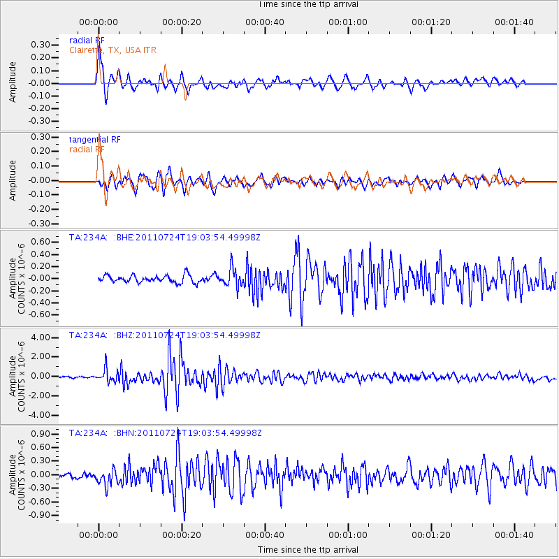
Earthquake location: Near East Coast Of Honshu, Japan
Earthquake latitude/longitude: 37.7/141.4
Earthquake time(UTC): 2011/07/24 (205) 18:51:24 GMT
Earthquake Depth: 35 km
Earthquake Magnitude: 6.3 MB, 5.9 MS, 6.3 MW, 6.3 MW
Earthquake Catalog/Contributor: WHDF/NEIC
Network: TA USArray Transportable Network (new EarthScope stations)
Station: 234A Clairette, TX, USA
Lat/Lon: 32.00 N/98.14 W
Elevation: 358 m
Distance: 91.2 deg
Az: 47.09 deg
Baz: 316.878 deg
Ray Param: 0.041617613
Estimated Moho Depth: 40.75 km
Estimated Crust Vp/Vs: 1.73
Assumed Crust Vp: 6.426 km/s
Estimated Crust Vs: 3.709 km/s
Estimated Crust Poisson's Ratio: 0.25
Radial Match: 88.76501 %
Radial Bump: 400
Transverse Match: 86.095276 %
Transverse Bump: 400
SOD ConfigId: 405110
Insert Time: 2011-12-29 05:58:00.340 +0000
GWidth: 2.5
Max Bumps: 400
Tol: 0.001

Signal To Noise

ChannelStoNSTALTA
TA:234A: :BHZ:20110724T19:03:54.49998Z9.3706146.943003E-77.409336E-8
TA:234A: :BHN:20110724T19:03:54.49998Z3.81546191.7905947E-74.692996E-8
TA:234A: :BHE:20110724T19:03:54.49998Z2.60828231.5481939E-75.935684E-8
Arrivals
Ps4.7 SECOND
PpPs17 SECOND
PsPs/PpSs22 SECOND