You are here: Home > Network List > TA - USArray Transportable Network (new EarthScope stations) Stations List
> Station 934A Benavides, TX, USA > Earthquake Result Viewer
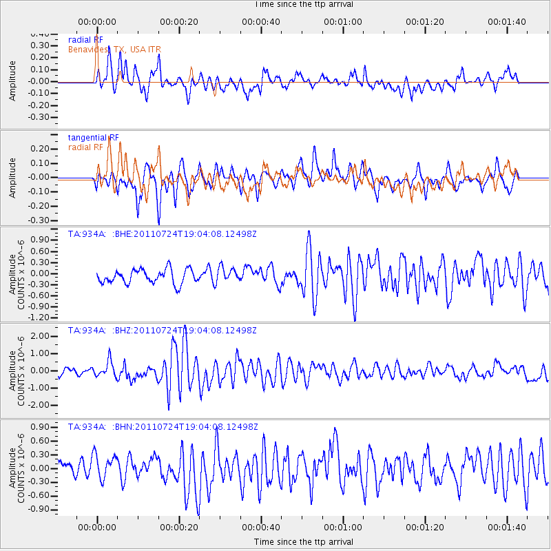
934A Benavides, TX, USA - Earthquake Result Viewer
*The percent match for this event was below the threshold and hence no stack was calculated.
| Earthquake location: |
Near East Coast Of Honshu, Japan |
| Earthquake latitude/longitude: |
37.7/141.4 |
| Earthquake time(UTC): |
2011/07/24 (205) 18:51:24 GMT |
| Earthquake Depth: |
35 km |
| Earthquake Magnitude: |
6.3 MB, 5.9 MS, 6.3 MW, 6.3 MW |
| Earthquake Catalog/Contributor: |
WHDF/NEIC |
|
| Network: |
TA USArray Transportable Network (new EarthScope stations) |
| Station: |
934A Benavides, TX, USA |
| Lat/Lon: |
27.60 N/98.52 W |
| Elevation: |
144 m |
|
| Distance: |
94.1 deg |
| Az: |
50.344 deg |
| Baz: |
316.538 deg |
| Ray Param: |
$rayparam |
*The percent match for this event was below the threshold and hence was not used in the summary stack. |
|
| Radial Match: |
71.12198 % |
| Radial Bump: |
400 |
| Transverse Match: |
69.82008 % |
| Transverse Bump: |
400 |
| SOD ConfigId: |
405110 |
| Insert Time: |
2011-12-29 05:59:01.751 +0000 |
| GWidth: |
2.5 |
| Max Bumps: |
400 |
| Tol: |
0.001 |
|
Signal To Noise
| Channel | StoN | STA | LTA |
| TA:934A: :BHZ:20110724T19:04:08.12498Z | 1.9480318 | 4.5675895E-7 | 2.3447203E-7 |
| TA:934A: :BHN:20110724T19:04:08.12498Z | 1.3340884 | 2.901199E-7 | 2.1746676E-7 |
| TA:934A: :BHE:20110724T19:04:08.12498Z | 1.040363 | 1.9503301E-7 | 1.8746633E-7 |
| Arrivals |
| Ps | |
| PpPs | |
| PsPs/PpSs | |


