N34A Lincoln, NE, USA - Earthquake Result Viewer
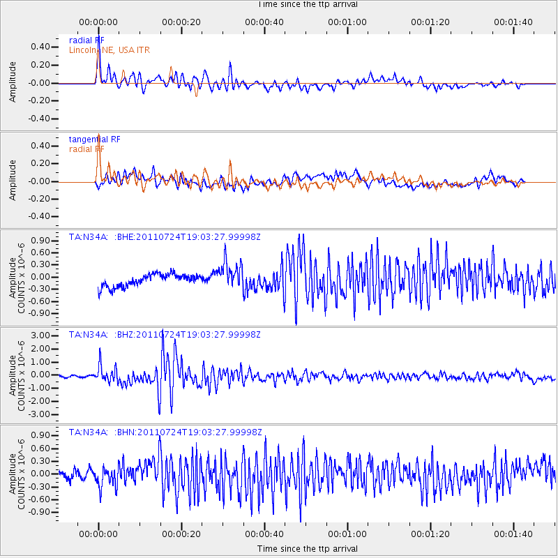
Earthquake location: Near East Coast Of Honshu, Japan
Earthquake latitude/longitude: 37.7/141.4
Earthquake time(UTC): 2011/07/24 (205) 18:51:24 GMT
Earthquake Depth: 35 km
Earthquake Magnitude: 6.3 MB, 5.9 MS, 6.3 MW, 6.3 MW
Earthquake Catalog/Contributor: WHDF/NEIC
Network: TA USArray Transportable Network (new EarthScope stations)
Station: N34A Lincoln, NE, USA
Lat/Lon: 40.84 N/96.50 W
Elevation: 401 m
Distance: 85.6 deg
Az: 40.137 deg
Baz: 317.649 deg
Ray Param: 0.04461991
Estimated Moho Depth: 19.75 km
Estimated Crust Vp/Vs: 1.84
Assumed Crust Vp: 6.498 km/s
Estimated Crust Vs: 3.536 km/s
Estimated Crust Poisson's Ratio: 0.29
Radial Match: 86.215744 %
Radial Bump: 400
Transverse Match: 73.57287 %
Transverse Bump: 400
SOD ConfigId: 405110
Insert Time: 2011-12-29 06:03:53.261 +0000
GWidth: 2.5
Max Bumps: 400
Tol: 0.001

Signal To Noise

ChannelStoNSTALTA
TA:N34A: :BHZ:20110724T19:03:27.99998Z8.4334016.515299E-77.725589E-8
TA:N34A: :BHN:20110724T19:03:27.99998Z2.08435062.243043E-71.0761352E-7
TA:N34A: :BHE:20110724T19:03:27.99998Z2.20118783.3512455E-71.5224714E-7
Arrivals
Ps2.6 SECOND
PpPs8.4 SECOND
PsPs/PpSs11 SECOND