
O33A Hebron, NE, USA - Earthquake Result Viewer
| ||||||||||||||||||
| ||||||||||||||||||
| ||||||||||||||||||
|
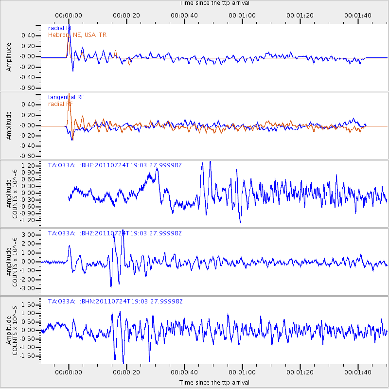
Signal To Noise
| Channel | StoN | STA | LTA |
| TA:O33A: :BHZ:20110724T19:03:27.99998Z | 8.046529 | 8.106121E-7 | 1.0074059E-7 |
| TA:O33A: :BHN:20110724T19:03:27.99998Z | 2.46248 | 3.2689E-7 | 1.3274828E-7 |
| TA:O33A: :BHE:20110724T19:03:27.99998Z | 3.224557 | 5.7648134E-7 | 1.7877846E-7 |
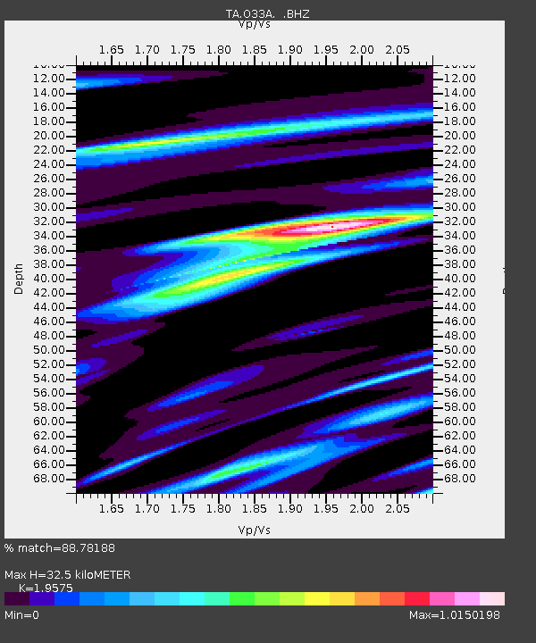
| Arrivals | |
| Ps | 4.9 SECOND |
| PpPs | 14 SECOND |
| PsPs/PpSs | 19 SECOND |

