O34A Beatrice, NE, USA - Earthquake Result Viewer
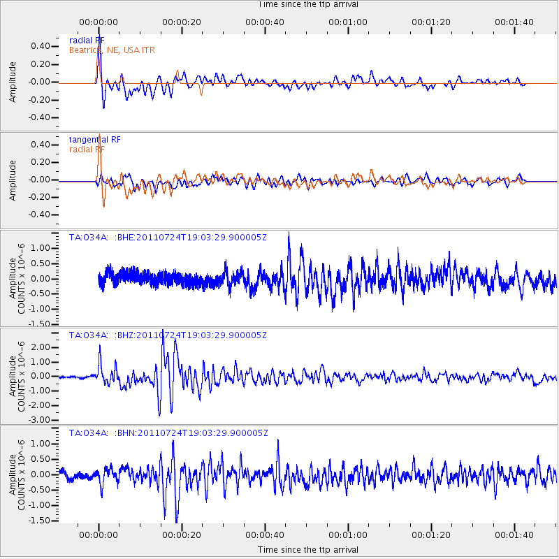
Earthquake location: Near East Coast Of Honshu, Japan
Earthquake latitude/longitude: 37.7/141.4
Earthquake time(UTC): 2011/07/24 (205) 18:51:24 GMT
Earthquake Depth: 35 km
Earthquake Magnitude: 6.3 MB, 5.9 MS, 6.3 MW, 6.3 MW
Earthquake Catalog/Contributor: WHDF/NEIC
Network: TA USArray Transportable Network (new EarthScope stations)
Station: O34A Beatrice, NE, USA
Lat/Lon: 40.18 N/96.69 W
Elevation: 409 m
Distance: 86.0 deg
Az: 40.689 deg
Baz: 317.565 deg
Ray Param: 0.044346683
Estimated Moho Depth: 12.0 km
Estimated Crust Vp/Vs: 2.10
Assumed Crust Vp: 6.498 km/s
Estimated Crust Vs: 3.098 km/s
Estimated Crust Poisson's Ratio: 0.35
Radial Match: 87.88216 %
Radial Bump: 400
Transverse Match: 70.75048 %
Transverse Bump: 400
SOD ConfigId: 405110
Insert Time: 2011-12-29 06:05:53.577 +0000
GWidth: 2.5
Max Bumps: 400
Tol: 0.001

Signal To Noise

ChannelStoNSTALTA
TA:O34A: :BHZ:20110724T19:03:29.900005Z7.7154376.736059E-78.730625E-8
TA:O34A: :BHN:20110724T19:03:29.900005Z2.00013162.5151977E-71.257516E-7
TA:O34A: :BHE:20110724T19:03:29.900005Z1.20998722.3223787E-71.9193416E-7
Arrivals
Ps2.1 SECOND
PpPs5.6 SECOND
PsPs/PpSs7.7 SECOND