K33A Hardington, NE, USA - Earthquake Result Viewer
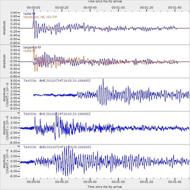
Earthquake location: Near East Coast Of Honshu, Japan
Earthquake latitude/longitude: 37.7/141.4
Earthquake time(UTC): 2011/07/24 (205) 18:51:24 GMT
Earthquake Depth: 35 km
Earthquake Magnitude: 6.3 MB, 5.9 MS, 6.3 MW, 6.3 MW
Earthquake Catalog/Contributor: WHDF/NEIC
Network: TA USArray Transportable Network (new EarthScope stations)
Station: K33A Hardington, NE, USA
Lat/Lon: 42.61 N/97.00 W
Elevation: 507 m
Distance: 84.0 deg
Az: 39.215 deg
Baz: 317.234 deg
Ray Param: 0.045728337
Estimated Moho Depth: 20.0 km
Estimated Crust Vp/Vs: 2.10
Assumed Crust Vp: 6.498 km/s
Estimated Crust Vs: 3.098 km/s
Estimated Crust Poisson's Ratio: 0.35
Radial Match: 93.88473 %
Radial Bump: 400
Transverse Match: 91.756645 %
Transverse Bump: 400
SOD ConfigId: 405110
Insert Time: 2011-12-29 06:07:09.027 +0000
GWidth: 2.5
Max Bumps: 400
Tol: 0.001

Signal To Noise

ChannelStoNSTALTA
TA:K33A: :BHZ:20110724T19:03:20.199993Z9.6622421.5287297E-61.5821688E-7
TA:K33A: :BHN:20110724T19:03:20.199993Z3.22905026.665426E-72.0642064E-7
TA:K33A: :BHE:20110724T19:03:20.199993Z3.85599529.574179E-72.4829333E-7
Arrivals
Ps3.5 SECOND
PpPs9.3 SECOND
PsPs/PpSs13 SECOND