J32A Parkston, SD, USA - Earthquake Result Viewer
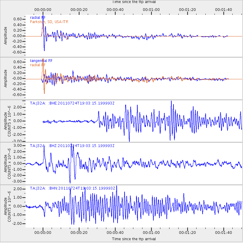
Earthquake location: Near East Coast Of Honshu, Japan
Earthquake latitude/longitude: 37.7/141.4
Earthquake time(UTC): 2011/07/24 (205) 18:51:24 GMT
Earthquake Depth: 35 km
Earthquake Magnitude: 6.3 MB, 5.9 MS, 6.3 MW, 6.3 MW
Earthquake Catalog/Contributor: WHDF/NEIC
Network: TA USArray Transportable Network (new EarthScope stations)
Station: J32A Parkston, SD, USA
Lat/Lon: 43.37 N/97.85 W
Elevation: 399 m
Distance: 83.0 deg
Az: 39.145 deg
Baz: 316.651 deg
Ray Param: 0.0464245
Estimated Moho Depth: 14.0 km
Estimated Crust Vp/Vs: 1.73
Assumed Crust Vp: 6.498 km/s
Estimated Crust Vs: 3.761 km/s
Estimated Crust Poisson's Ratio: 0.25
Radial Match: 88.78124 %
Radial Bump: 400
Transverse Match: 87.47037 %
Transverse Bump: 400
SOD ConfigId: 405110
Insert Time: 2011-12-29 06:07:13.784 +0000
GWidth: 2.5
Max Bumps: 400
Tol: 0.001

Signal To Noise

ChannelStoNSTALTA
TA:J32A: :BHZ:20110724T19:03:15.199993Z11.7312191.0299186E-68.779297E-8
TA:J32A: :BHN:20110724T19:03:15.199993Z6.051814.0039083E-76.616051E-8
TA:J32A: :BHE:20110724T19:03:15.199993Z7.8748496.070863E-77.7091805E-8
Arrivals
Ps1.6 SECOND
PpPs5.7 SECOND
PsPs/PpSs7.3 SECOND