K35A Storm Lake, IA, USA - Earthquake Result Viewer
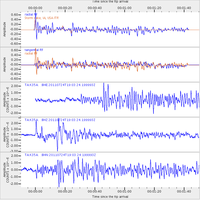
Earthquake location: Near East Coast Of Honshu, Japan
Earthquake latitude/longitude: 37.7/141.4
Earthquake time(UTC): 2011/07/24 (205) 18:51:24 GMT
Earthquake Depth: 35 km
Earthquake Magnitude: 6.3 MB, 5.9 MS, 6.3 MW, 6.3 MW
Earthquake Catalog/Contributor: WHDF/NEIC
Network: TA USArray Transportable Network (new EarthScope stations)
Station: K35A Storm Lake, IA, USA
Lat/Lon: 42.72 N/95.23 W
Elevation: 439 m
Distance: 84.8 deg
Az: 38.166 deg
Baz: 318.326 deg
Ray Param: 0.045168184
Estimated Moho Depth: 61.5 km
Estimated Crust Vp/Vs: 1.76
Assumed Crust Vp: 6.53 km/s
Estimated Crust Vs: 3.71 km/s
Estimated Crust Poisson's Ratio: 0.26
Radial Match: 88.8607 %
Radial Bump: 400
Transverse Match: 80.13331 %
Transverse Bump: 400
SOD ConfigId: 405110
Insert Time: 2011-12-29 06:07:48.246 +0000
GWidth: 2.5
Max Bumps: 400
Tol: 0.001

Signal To Noise

ChannelStoNSTALTA
TA:K35A: :BHZ:20110724T19:03:24.199993Z13.8301117.9631695E-75.7578493E-8
TA:K35A: :BHN:20110724T19:03:24.199993Z2.9239464.4816056E-71.5327252E-7
TA:K35A: :BHE:20110724T19:03:24.199993Z2.36678933.4538493E-71.4592973E-7
Arrivals
Ps7.3 SECOND
PpPs25 SECOND
PsPs/PpSs33 SECOND