
J31A Geddes, SD, USA - Earthquake Result Viewer
| ||||||||||||||||||
| ||||||||||||||||||
| ||||||||||||||||||
|
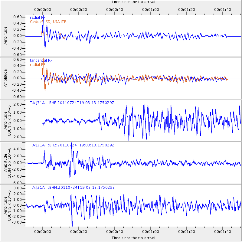
Signal To Noise
| Channel | StoN | STA | LTA |
| TA:J31A: :BHZ:20110724T19:03:13.175029Z | 15.601652 | 1.247208E-6 | 7.994076E-8 |
| TA:J31A: :BHN:20110724T19:03:13.175029Z | 3.4814813 | 4.7325716E-7 | 1.3593557E-7 |
| TA:J31A: :BHE:20110724T19:03:13.175029Z | 2.791667 | 4.5648324E-7 | 1.6351636E-7 |
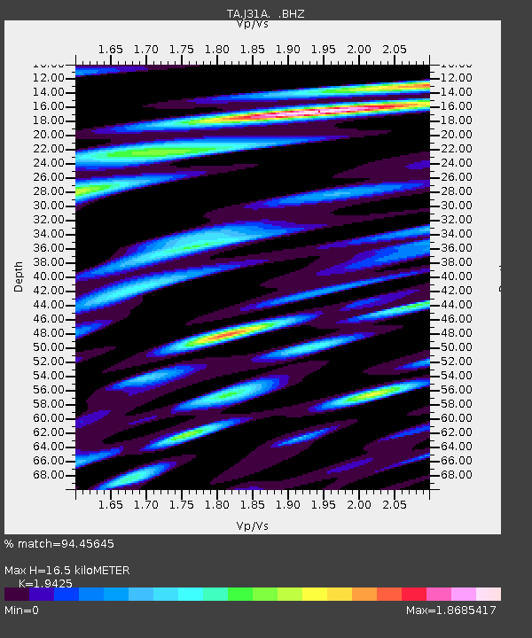
| Arrivals | |
| Ps | 2.4 SECOND |
| PpPs | 7.3 SECOND |
| PsPs/PpSs | 9.7 SECOND |

