O02D Mt. Diablo Meridian, CA, USA - Earthquake Result Viewer
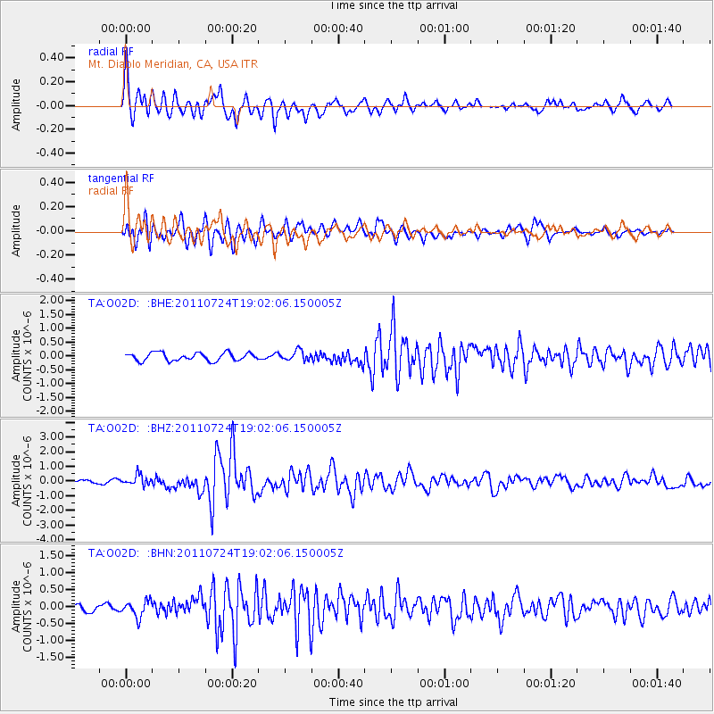
Earthquake location: Near East Coast Of Honshu, Japan
Earthquake latitude/longitude: 37.7/141.4
Earthquake time(UTC): 2011/07/24 (205) 18:51:24 GMT
Earthquake Depth: 35 km
Earthquake Magnitude: 6.3 MB, 5.9 MS, 6.3 MW, 6.3 MW
Earthquake Catalog/Contributor: WHDF/NEIC
Network: TA USArray Transportable Network (new EarthScope stations)
Station: O02D Mt. Diablo Meridian, CA, USA
Lat/Lon: 40.18 N/122.79 W
Elevation: 965 m
Distance: 70.7 deg
Az: 53.85 deg
Baz: 303.317 deg
Ray Param: 0.054733418
Estimated Moho Depth: 69.0 km
Estimated Crust Vp/Vs: 1.65
Assumed Crust Vp: 6.566 km/s
Estimated Crust Vs: 3.967 km/s
Estimated Crust Poisson's Ratio: 0.21
Radial Match: 89.32864 %
Radial Bump: 400
Transverse Match: 76.60511 %
Transverse Bump: 400
SOD ConfigId: 405110
Insert Time: 2011-12-29 06:08:19.522 +0000
GWidth: 2.5
Max Bumps: 400
Tol: 0.001

Signal To Noise

ChannelStoNSTALTA
TA:O02D: :BHZ:20110724T19:02:06.150005Z3.20870663.5488554E-71.1060081E-7
TA:O02D: :BHN:20110724T19:02:06.150005Z1.98273782.3709005E-71.1957711E-7
TA:O02D: :BHE:20110724T19:02:06.150005Z1.22220611.7797636E-71.4561896E-7
Arrivals
Ps7.2 SECOND
PpPs27 SECOND
PsPs/PpSs34 SECOND