O03D Paynes Creek, CA, USA - Earthquake Result Viewer
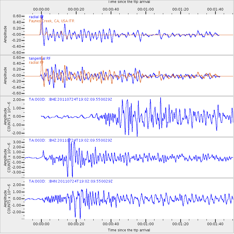
Earthquake location: Near East Coast Of Honshu, Japan
Earthquake latitude/longitude: 37.7/141.4
Earthquake time(UTC): 2011/07/24 (205) 18:51:24 GMT
Earthquake Depth: 35 km
Earthquake Magnitude: 6.3 MB, 5.9 MS, 6.3 MW, 6.3 MW
Earthquake Catalog/Contributor: WHDF/NEIC
Network: TA USArray Transportable Network (new EarthScope stations)
Station: O03D Paynes Creek, CA, USA
Lat/Lon: 40.29 N/121.80 W
Elevation: 968 m
Distance: 71.3 deg
Az: 53.304 deg
Baz: 303.775 deg
Ray Param: 0.054368377
Estimated Moho Depth: 22.25 km
Estimated Crust Vp/Vs: 1.87
Assumed Crust Vp: 6.566 km/s
Estimated Crust Vs: 3.511 km/s
Estimated Crust Poisson's Ratio: 0.30
Radial Match: 90.93954 %
Radial Bump: 400
Transverse Match: 92.49127 %
Transverse Bump: 400
SOD ConfigId: 405110
Insert Time: 2011-12-29 06:08:28.834 +0000
GWidth: 2.5
Max Bumps: 400
Tol: 0.001

Signal To Noise

ChannelStoNSTALTA
TA:O03D: :BHZ:20110724T19:02:09.550029Z3.59043344.3629058E-71.2151474E-7
TA:O03D: :BHN:20110724T19:02:09.550029Z1.97549462.0461462E-71.035764E-7
TA:O03D: :BHE:20110724T19:02:09.550029Z2.15025571.9190136E-78.924584E-8
Arrivals
Ps3.1 SECOND
PpPs9.4 SECOND
PsPs/PpSs12 SECOND