E04D Cinebar, WA, USA - Earthquake Result Viewer
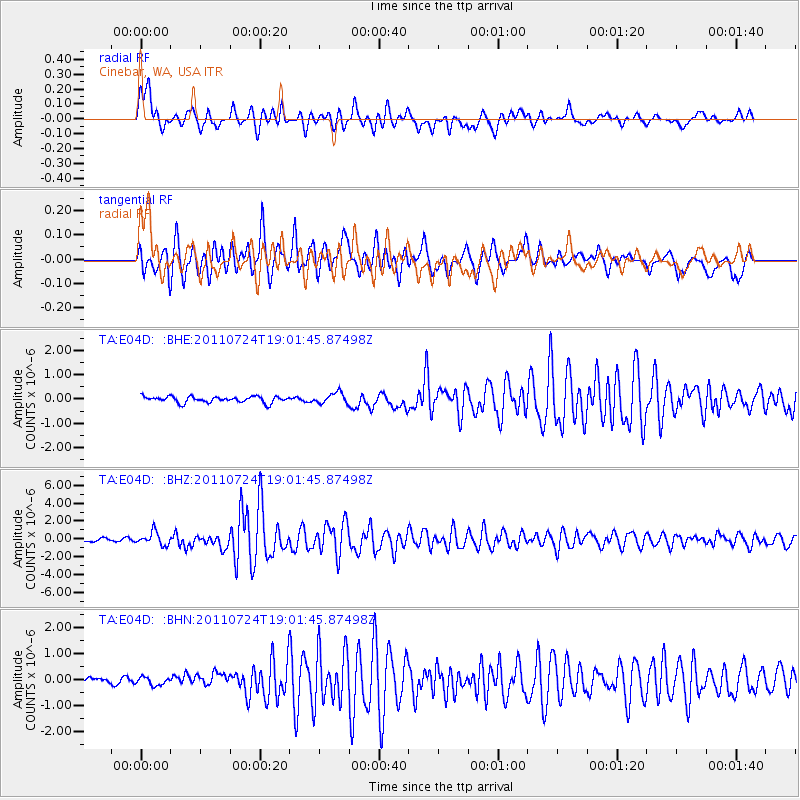
Earthquake location: Near East Coast Of Honshu, Japan
Earthquake latitude/longitude: 37.7/141.4
Earthquake time(UTC): 2011/07/24 (205) 18:51:24 GMT
Earthquake Depth: 35 km
Earthquake Magnitude: 6.3 MB, 5.9 MS, 6.3 MW, 6.3 MW
Earthquake Catalog/Contributor: WHDF/NEIC
Network: TA USArray Transportable Network (new EarthScope stations)
Station: E04D Cinebar, WA, USA
Lat/Lon: 46.56 N/122.57 W
Elevation: 204 m
Distance: 67.5 deg
Az: 47.99 deg
Baz: 301.375 deg
Ray Param: 0.05689047
Estimated Moho Depth: 14.75 km
Estimated Crust Vp/Vs: 1.60
Assumed Crust Vp: 6.566 km/s
Estimated Crust Vs: 4.104 km/s
Estimated Crust Poisson's Ratio: 0.18
Radial Match: 84.272514 %
Radial Bump: 400
Transverse Match: 89.58949 %
Transverse Bump: 400
SOD ConfigId: 405110
Insert Time: 2011-12-29 06:10:51.495 +0000
GWidth: 2.5
Max Bumps: 400
Tol: 0.001

Signal To Noise

ChannelStoNSTALTA
TA:E04D: :BHZ:20110724T19:01:45.87498Z5.57738547.361163E-71.3198233E-7
TA:E04D: :BHN:20110724T19:01:45.87498Z0.970686851.5642756E-71.6115142E-7
TA:E04D: :BHE:20110724T19:01:45.87498Z1.76741732.2320543E-71.2628904E-7
Arrivals
Ps1.4 SECOND
PpPs5.6 SECOND
PsPs/PpSs7.0 SECOND