D36A Goodland, MN, USA - Earthquake Result Viewer
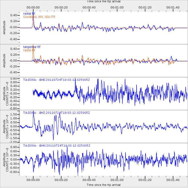
Earthquake location: Near East Coast Of Honshu, Japan
Earthquake latitude/longitude: 37.7/141.4
Earthquake time(UTC): 2011/07/24 (205) 18:51:24 GMT
Earthquake Depth: 35 km
Earthquake Magnitude: 6.3 MB, 5.9 MS, 6.3 MW, 6.3 MW
Earthquake Catalog/Contributor: WHDF/NEIC
Network: TA USArray Transportable Network (new EarthScope stations)
Station: D36A Goodland, MN, USA
Lat/Lon: 47.18 N/93.16 W
Elevation: 434 m
Distance: 82.4 deg
Az: 34.103 deg
Baz: 319.331 deg
Ray Param: 0.046849675
Estimated Moho Depth: 45.25 km
Estimated Crust Vp/Vs: 1.76
Assumed Crust Vp: 6.571 km/s
Estimated Crust Vs: 3.739 km/s
Estimated Crust Poisson's Ratio: 0.26
Radial Match: 85.19127 %
Radial Bump: 400
Transverse Match: 66.9445 %
Transverse Bump: 400
SOD ConfigId: 405110
Insert Time: 2011-12-29 06:11:18.017 +0000
GWidth: 2.5
Max Bumps: 400
Tol: 0.001

Signal To Noise

ChannelStoNSTALTA
TA:D36A: :BHZ:20110724T19:03:12.025005Z5.98336846.8071967E-71.13768635E-7
TA:D36A: :BHN:20110724T19:03:12.025005Z2.84815243.1908326E-71.1203167E-7
TA:D36A: :BHE:20110724T19:03:12.025005Z2.2595572.5788574E-71.1413112E-7
Arrivals
Ps5.4 SECOND
PpPs18 SECOND
PsPs/PpSs24 SECOND