F31A Hecla, SD, USA - Earthquake Result Viewer
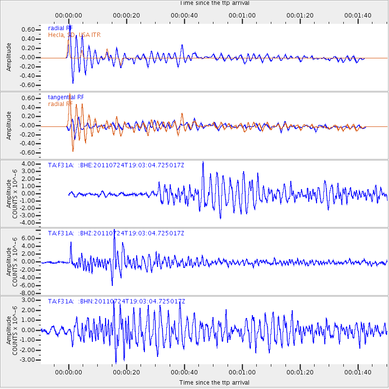
Earthquake location: Near East Coast Of Honshu, Japan
Earthquake latitude/longitude: 37.7/141.4
Earthquake time(UTC): 2011/07/24 (205) 18:51:24 GMT
Earthquake Depth: 35 km
Earthquake Magnitude: 6.3 MB, 5.9 MS, 6.3 MW, 6.3 MW
Earthquake Catalog/Contributor: WHDF/NEIC
Network: TA USArray Transportable Network (new EarthScope stations)
Station: F31A Hecla, SD, USA
Lat/Lon: 45.86 N/98.25 W
Elevation: 412 m
Distance: 81.0 deg
Az: 37.625 deg
Baz: 316.156 deg
Ray Param: 0.04782056
Estimated Moho Depth: 29.25 km
Estimated Crust Vp/Vs: 2.05
Assumed Crust Vp: 6.53 km/s
Estimated Crust Vs: 3.189 km/s
Estimated Crust Poisson's Ratio: 0.34
Radial Match: 95.02931 %
Radial Bump: 345
Transverse Match: 92.73778 %
Transverse Bump: 400
SOD ConfigId: 405110
Insert Time: 2011-12-29 06:11:43.248 +0000
GWidth: 2.5
Max Bumps: 400
Tol: 0.001

Signal To Noise

ChannelStoNSTALTA
TA:F31A: :BHZ:20110724T19:03:04.725017Z12.91832351.3966827E-61.081164E-7
TA:F31A: :BHN:20110724T19:03:04.725017Z3.06074646.699774E-72.1889346E-7
TA:F31A: :BHE:20110724T19:03:04.725017Z4.9641087.8777447E-71.5869406E-7
Arrivals
Ps4.8 SECOND
PpPs13 SECOND
PsPs/PpSs18 SECOND