F35A Swanville, MN, USA - Earthquake Result Viewer
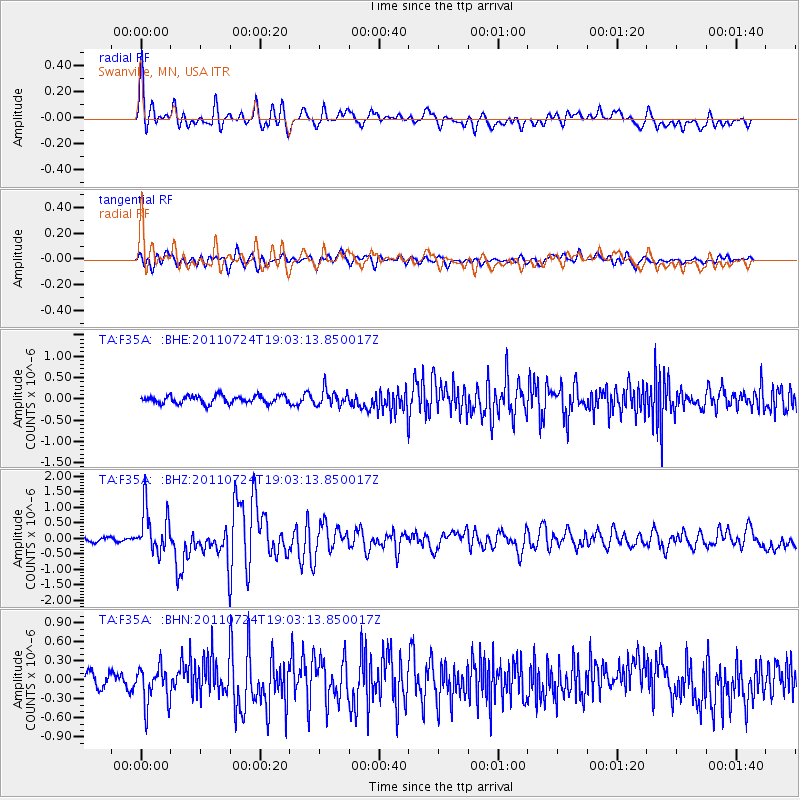
Earthquake location: Near East Coast Of Honshu, Japan
Earthquake latitude/longitude: 37.7/141.4
Earthquake time(UTC): 2011/07/24 (205) 18:51:24 GMT
Earthquake Depth: 35 km
Earthquake Magnitude: 6.3 MB, 5.9 MS, 6.3 MW, 6.3 MW
Earthquake Catalog/Contributor: WHDF/NEIC
Network: TA USArray Transportable Network (new EarthScope stations)
Station: F35A Swanville, MN, USA
Lat/Lon: 45.86 N/94.57 W
Elevation: 376 m
Distance: 82.8 deg
Az: 35.717 deg
Baz: 318.52 deg
Ray Param: 0.046603262
Estimated Moho Depth: 47.75 km
Estimated Crust Vp/Vs: 1.75
Assumed Crust Vp: 6.571 km/s
Estimated Crust Vs: 3.765 km/s
Estimated Crust Poisson's Ratio: 0.26
Radial Match: 85.60375 %
Radial Bump: 400
Transverse Match: 78.39541 %
Transverse Bump: 400
SOD ConfigId: 405110
Insert Time: 2011-12-29 06:11:56.170 +0000
GWidth: 2.5
Max Bumps: 400
Tol: 0.001

Signal To Noise

ChannelStoNSTALTA
TA:F35A: :BHZ:20110724T19:03:13.850017Z7.99919037.200689E-79.001772E-8
TA:F35A: :BHN:20110724T19:03:13.850017Z3.36868553.0134797E-78.945565E-8
TA:F35A: :BHE:20110724T19:03:13.850017Z1.9755931.824259E-79.233982E-8
Arrivals
Ps5.6 SECOND
PpPs19 SECOND
PsPs/PpSs25 SECOND