A33A Warroad, MN, USA - Earthquake Result Viewer
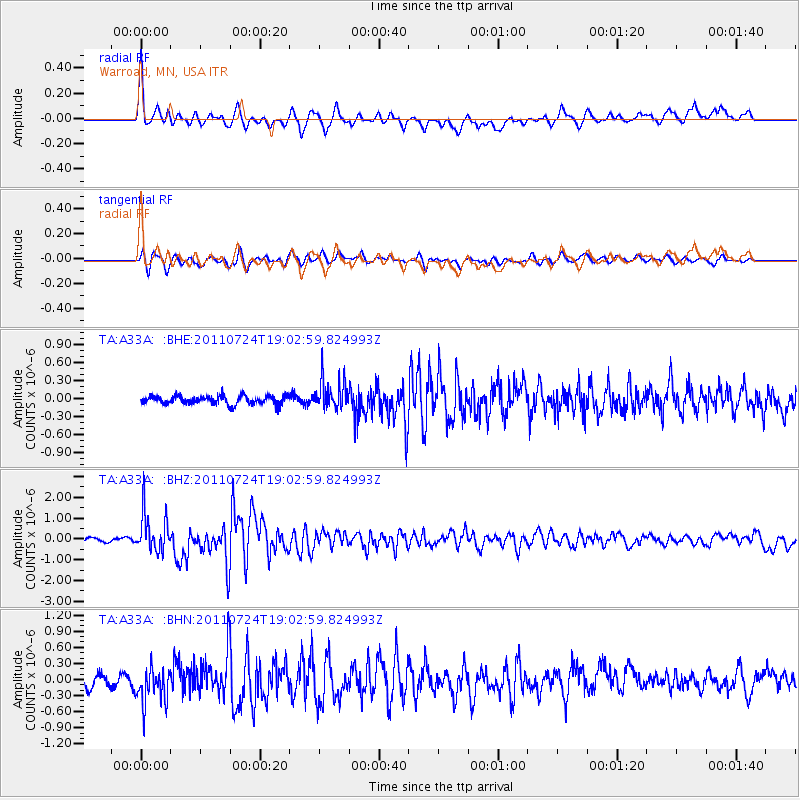
Earthquake location: Near East Coast Of Honshu, Japan
Earthquake latitude/longitude: 37.7/141.4
Earthquake time(UTC): 2011/07/24 (205) 18:51:24 GMT
Earthquake Depth: 35 km
Earthquake Magnitude: 6.3 MB, 5.9 MS, 6.3 MW, 6.3 MW
Earthquake Catalog/Contributor: WHDF/NEIC
Network: TA USArray Transportable Network (new EarthScope stations)
Station: A33A Warroad, MN, USA
Lat/Lon: 48.94 N/95.39 W
Elevation: 329 m
Distance: 80.1 deg
Az: 34.054 deg
Baz: 317.673 deg
Ray Param: 0.048448708
Estimated Moho Depth: 30.25 km
Estimated Crust Vp/Vs: 1.60
Assumed Crust Vp: 6.419 km/s
Estimated Crust Vs: 4.012 km/s
Estimated Crust Poisson's Ratio: 0.18
Radial Match: 83.455246 %
Radial Bump: 400
Transverse Match: 80.84069 %
Transverse Bump: 400
SOD ConfigId: 405110
Insert Time: 2011-12-29 06:13:08.515 +0000
GWidth: 2.5
Max Bumps: 400
Tol: 0.001

Signal To Noise

ChannelStoNSTALTA
TA:A33A: :BHZ:20110724T19:02:59.824993Z9.4914279.4123345E-79.916669E-8
TA:A33A: :BHN:20110724T19:02:59.824993Z3.27625473.3939608E-71.0359271E-7
TA:A33A: :BHE:20110724T19:02:59.824993Z3.5963412.5593374E-77.116503E-8
Arrivals
Ps2.9 SECOND
PpPs12 SECOND
PsPs/PpSs15 SECOND