U40A Yellville, AR, USA - Earthquake Result Viewer
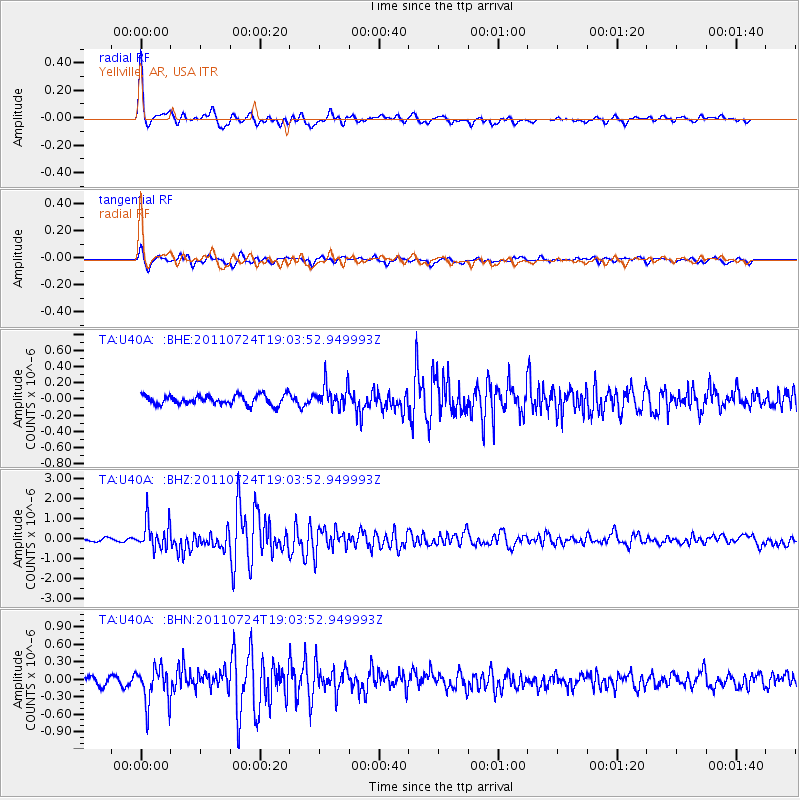
Earthquake location: Near East Coast Of Honshu, Japan
Earthquake latitude/longitude: 37.7/141.4
Earthquake time(UTC): 2011/07/24 (205) 18:51:24 GMT
Earthquake Depth: 35 km
Earthquake Magnitude: 6.3 MB, 5.9 MS, 6.3 MW, 6.3 MW
Earthquake Catalog/Contributor: WHDF/NEIC
Network: TA USArray Transportable Network (new EarthScope stations)
Station: U40A Yellville, AR, USA
Lat/Lon: 36.36 N/92.85 W
Elevation: 374 m
Distance: 90.8 deg
Az: 40.934 deg
Baz: 319.942 deg
Ray Param: 0.04164164
Estimated Moho Depth: 45.75 km
Estimated Crust Vp/Vs: 1.70
Assumed Crust Vp: 6.53 km/s
Estimated Crust Vs: 3.836 km/s
Estimated Crust Poisson's Ratio: 0.24
Radial Match: 92.32304 %
Radial Bump: 370
Transverse Match: 75.08909 %
Transverse Bump: 400
SOD ConfigId: 405110
Insert Time: 2011-12-29 06:18:13.180 +0000
GWidth: 2.5
Max Bumps: 400
Tol: 0.001

Signal To Noise

ChannelStoNSTALTA
TA:U40A: :BHZ:20110724T19:03:52.949993Z11.1735197.067046E-76.324817E-8
TA:U40A: :BHN:20110724T19:03:52.949993Z4.5222343.1732318E-77.016956E-8
TA:U40A: :BHE:20110724T19:03:52.949993Z2.4490621.4528443E-75.9322478E-8
Arrivals
Ps5.0 SECOND
PpPs19 SECOND
PsPs/PpSs24 SECOND