
V40A Witts Springs, AR, USA - Earthquake Result Viewer
| ||||||||||||||||||
| ||||||||||||||||||
| ||||||||||||||||||
|
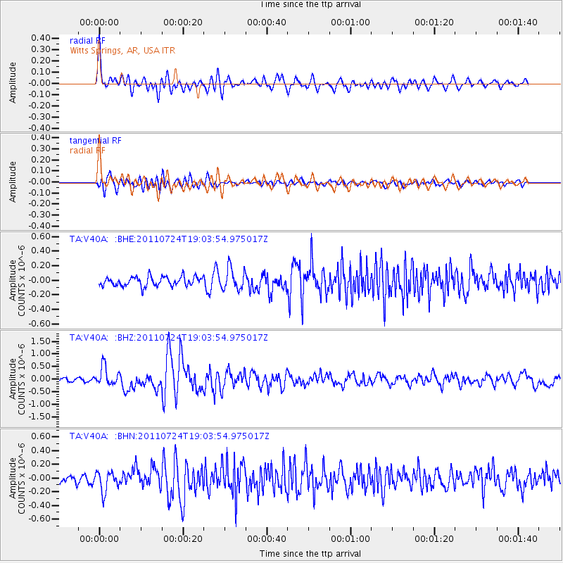
Signal To Noise
| Channel | StoN | STA | LTA |
| TA:V40A: :BHZ:20110724T19:03:54.975017Z | 5.2327876 | 3.7921336E-7 | 7.246871E-8 |
| TA:V40A: :BHN:20110724T19:03:54.975017Z | 2.4234254 | 1.487113E-7 | 6.136409E-8 |
| TA:V40A: :BHE:20110724T19:03:54.975017Z | 2.3444874 | 1.4858328E-7 | 6.3375595E-8 |
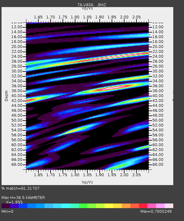
| Arrivals | |
| Ps | 5.5 SECOND |
| PpPs | 16 SECOND |
| PsPs/PpSs | 22 SECOND |

