Y41A Eaglette Bearden, AR, USA - Earthquake Result Viewer
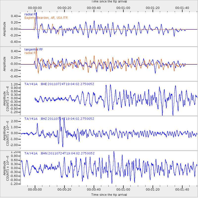
Earthquake location: Near East Coast Of Honshu, Japan
Earthquake latitude/longitude: 37.7/141.4
Earthquake time(UTC): 2011/07/24 (205) 18:51:24 GMT
Earthquake Depth: 35 km
Earthquake Magnitude: 6.3 MB, 5.9 MS, 6.3 MW, 6.3 MW
Earthquake Catalog/Contributor: WHDF/NEIC
Network: TA USArray Transportable Network (new EarthScope stations)
Station: Y41A Eaglette Bearden, AR, USA
Lat/Lon: 33.88 N/92.61 W
Elevation: 99 m
Distance: 92.8 deg
Az: 42.37 deg
Baz: 320.035 deg
Ray Param: 0.041366715
Estimated Moho Depth: 12.0 km
Estimated Crust Vp/Vs: 1.60
Assumed Crust Vp: 6.245 km/s
Estimated Crust Vs: 3.903 km/s
Estimated Crust Poisson's Ratio: 0.18
Radial Match: 80.20781 %
Radial Bump: 400
Transverse Match: 64.928734 %
Transverse Bump: 396
SOD ConfigId: 405110
Insert Time: 2011-12-29 06:21:47.677 +0000
GWidth: 2.5
Max Bumps: 400
Tol: 0.001

Signal To Noise

ChannelStoNSTALTA
TA:Y41A: :BHZ:20110724T19:04:02.275005Z7.8557055.40496E-76.8803E-8
TA:Y41A: :BHN:20110724T19:04:02.275005Z0.555511531.6892305E-73.0408557E-7
TA:Y41A: :BHE:20110724T19:04:02.275005Z3.03193263.666559E-71.2093142E-7
Arrivals
Ps1.2 SECOND
PpPs4.9 SECOND
PsPs/PpSs6.1 SECOND