V41A Mountainview, AR, USA - Earthquake Result Viewer
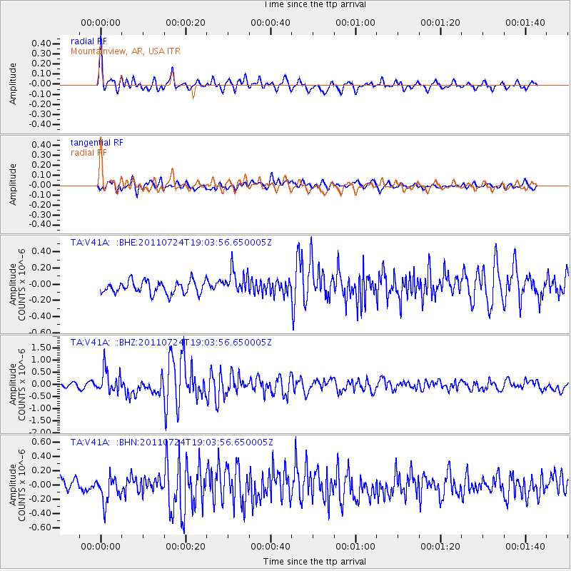
Earthquake location: Near East Coast Of Honshu, Japan
Earthquake latitude/longitude: 37.7/141.4
Earthquake time(UTC): 2011/07/24 (205) 18:51:24 GMT
Earthquake Depth: 35 km
Earthquake Magnitude: 6.3 MB, 5.9 MS, 6.3 MW, 6.3 MW
Earthquake Catalog/Contributor: WHDF/NEIC
Network: TA USArray Transportable Network (new EarthScope stations)
Station: V41A Mountainview, AR, USA
Lat/Lon: 35.79 N/92.16 W
Elevation: 413 m
Distance: 91.6 deg
Az: 40.865 deg
Baz: 320.353 deg
Ray Param: 0.04157264
Estimated Moho Depth: 17.75 km
Estimated Crust Vp/Vs: 1.89
Assumed Crust Vp: 6.498 km/s
Estimated Crust Vs: 3.429 km/s
Estimated Crust Poisson's Ratio: 0.31
Radial Match: 82.06752 %
Radial Bump: 400
Transverse Match: 70.1707 %
Transverse Bump: 400
SOD ConfigId: 405110
Insert Time: 2011-12-29 06:22:15.726 +0000
GWidth: 2.5
Max Bumps: 400
Tol: 0.001

Signal To Noise

ChannelStoNSTALTA
TA:V41A: :BHZ:20110724T19:03:56.650005Z8.530734.7496144E-75.567653E-8
TA:V41A: :BHN:20110724T19:03:56.650005Z1.81840351.7841391E-79.811569E-8
TA:V41A: :BHE:20110724T19:03:56.650005Z1.94898381.5072808E-77.733676E-8
Arrivals
Ps2.5 SECOND
PpPs7.8 SECOND
PsPs/PpSs10 SECOND