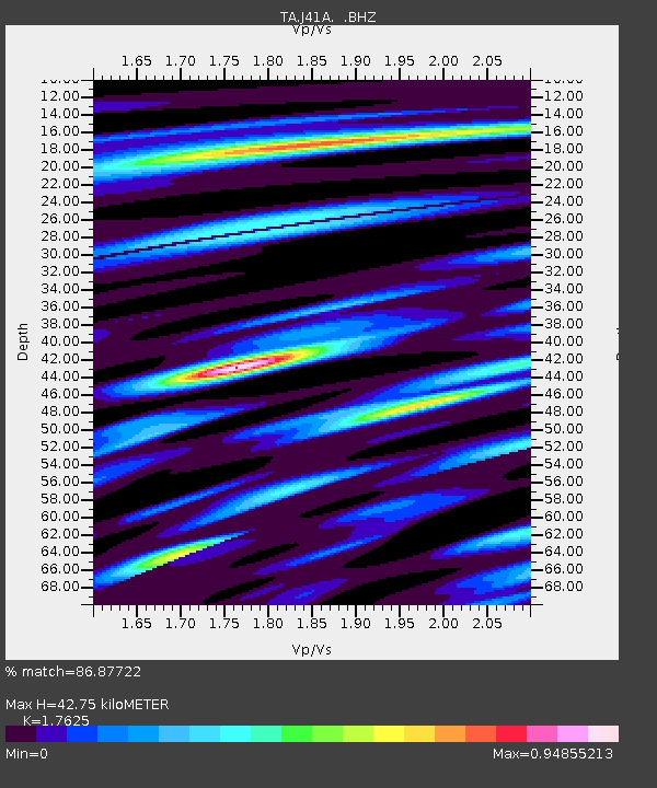
J41A Loganville, WI, USA - Earthquake Result Viewer

Earthquake location: Near East Coast Of Honshu, Japan
Earthquake latitude/longitude: 37.7/141.4
Earthquake time(UTC): 2011/07/24 (205) 18:51:24 GMT
Earthquake Depth: 35 km
Earthquake Magnitude: 6.3 MB, 5.9 MS, 6.3 MW, 6.3 MW
Earthquake Catalog/Contributor: WHDF/NEIC
Network: TA USArray Transportable Network (new EarthScope stations)
Station: J41A Loganville, WI, USA
Lat/Lon: 43.37 N/90.01 W
Elevation: 360 m
Distance: 86.8 deg
Az: 34.814 deg
Baz: 321.631 deg
Ray Param: 0.043756854
Estimated Moho Depth: 42.75 km
Estimated Crust Vp/Vs: 1.76
Assumed Crust Vp: 6.53 km/s
Estimated Crust Vs: 3.705 km/s
Estimated Crust Poisson's Ratio: 0.26
Radial Match: 86.87722 %
Radial Bump: 400
Transverse Match: 85.945114 %
Transverse Bump: 400
SOD ConfigId: 405110
Insert Time: 2011-12-29 06:24:13.725 +0000
GWidth: 2.5
Max Bumps: 400
Tol: 0.001

Signal To Noise

ChannelStoNSTALTA
TA:J41A: :BHZ:20110724T19:03:33.900005Z10.2726631.1003037E-61.07109884E-7
TA:J41A: :BHN:20110724T19:03:33.900005Z3.34824322.476632E-77.39681E-8
TA:J41A: :BHE:20110724T19:03:33.900005Z2.9459432.9663985E-71.0069436E-7
Arrivals
Ps5.1 SECOND
PpPs18 SECOND
PsPs/PpSs23 SECOND