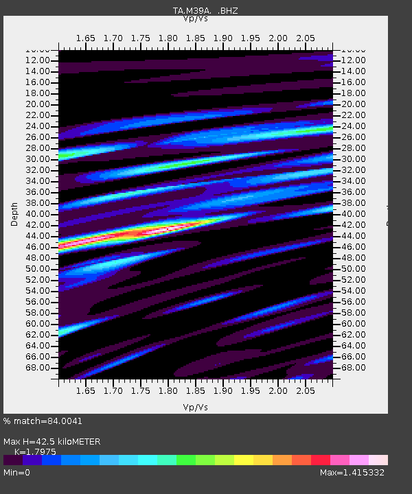
M39A Webster, IA, USA - Earthquake Result Viewer

Earthquake location: Near East Coast Of Honshu, Japan
Earthquake latitude/longitude: 37.7/141.4
Earthquake time(UTC): 2011/07/24 (205) 18:51:24 GMT
Earthquake Depth: 35 km
Earthquake Magnitude: 6.3 MB, 5.9 MS, 6.3 MW, 6.3 MW
Earthquake Catalog/Contributor: WHDF/NEIC
Network: TA USArray Transportable Network (new EarthScope stations)
Station: M39A Webster, IA, USA
Lat/Lon: 41.48 N/92.17 W
Elevation: 264 m
Distance: 87.2 deg
Az: 37.246 deg
Baz: 320.306 deg
Ray Param: 0.04342154
Estimated Moho Depth: 42.5 km
Estimated Crust Vp/Vs: 1.80
Assumed Crust Vp: 6.498 km/s
Estimated Crust Vs: 3.615 km/s
Estimated Crust Poisson's Ratio: 0.28
Radial Match: 84.0041 %
Radial Bump: 400
Transverse Match: 79.07831 %
Transverse Bump: 400
SOD ConfigId: 405110
Insert Time: 2011-12-29 06:24:21.922 +0000
GWidth: 2.5
Max Bumps: 400
Tol: 0.001

Signal To Noise

ChannelStoNSTALTA
TA:M39A: :BHZ:20110724T19:03:36.12498Z8.9930851.0753303E-61.1957302E-7
TA:M39A: :BHN:20110724T19:03:36.12498Z1.81361193.2185656E-71.7746717E-7
TA:M39A: :BHE:20110724T19:03:36.12498Z1.85606933.5605933E-71.9183514E-7
Arrivals
Ps5.3 SECOND
PpPs18 SECOND
PsPs/PpSs23 SECOND