
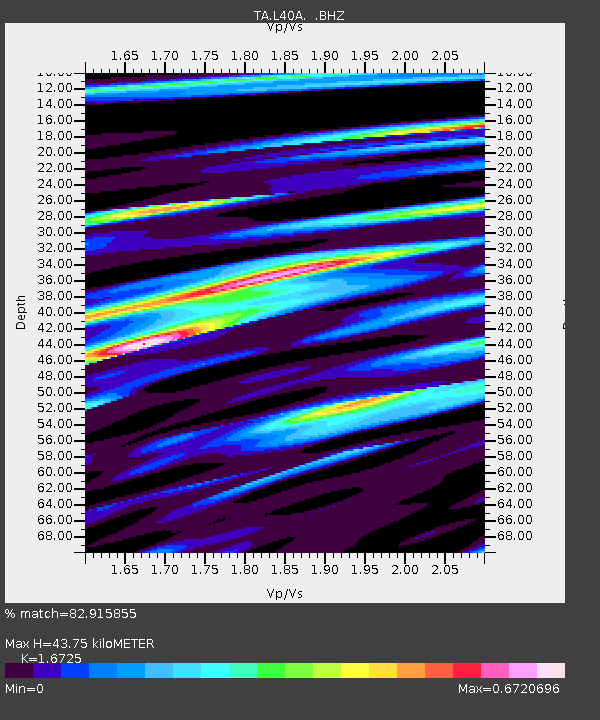
L40A Anamosa, IA, USA - Earthquake Result Viewer
| ||||||||||||||||||
| ||||||||||||||||||
| ||||||||||||||||||
|
Signal To Noise
| Channel | StoN | STA | LTA |
| TA:L40A: :BHZ:20110724T19:03:36.12498Z | 9.881304 | 1.0898108E-6 | 1.1029018E-7 |
| TA:L40A: :BHN:20110724T19:03:36.12498Z | 3.4099412 | 3.6490587E-7 | 1.0701236E-7 |
| TA:L40A: :BHE:20110724T19:03:36.12498Z | 2.357595 | 2.568909E-7 | 1.0896312E-7 |
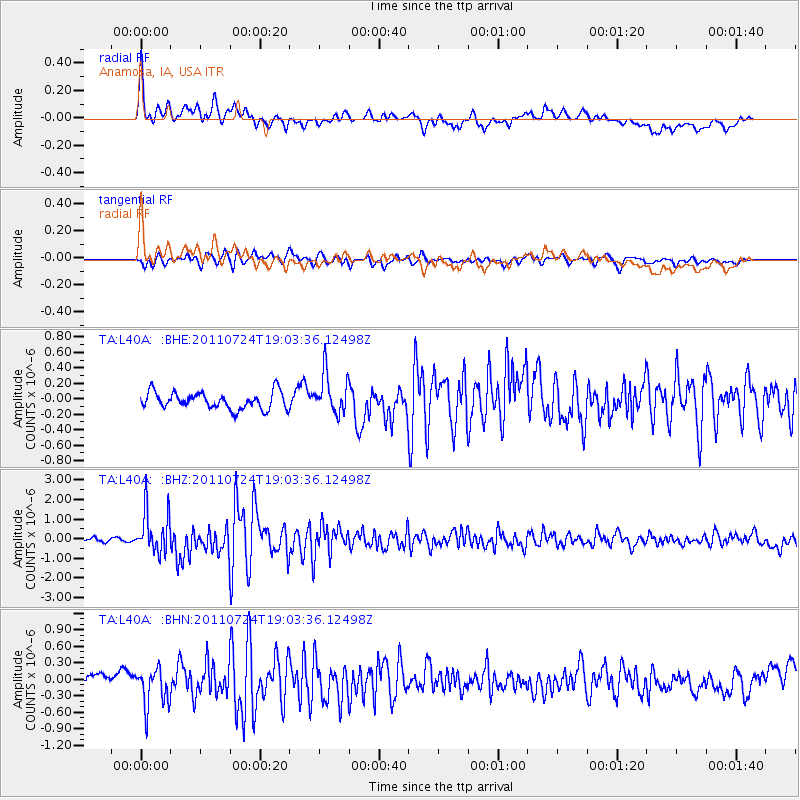
| Arrivals | |
| Ps | 4.6 SECOND |
| PpPs | 17 SECOND |
| PsPs/PpSs | 22 SECOND |

