
GNW Green Mountain (BB) - Earthquake Result Viewer
| ||||||||||||||||||
| ||||||||||||||||||
| ||||||||||||||||||
|
Signal To Noise
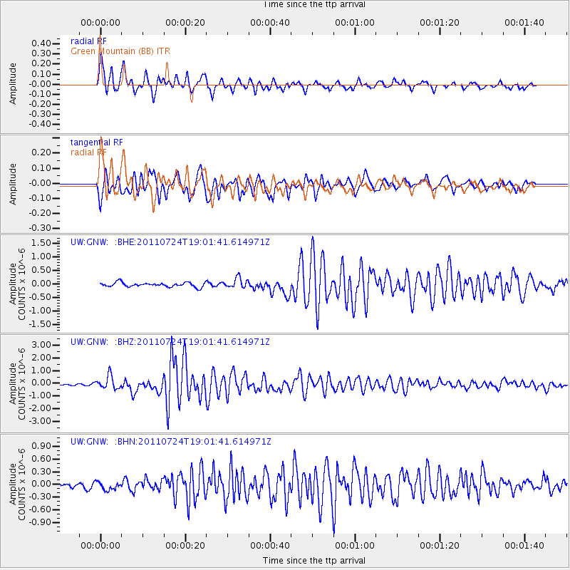
| Channel | StoN | STA | LTA |
| UW:GNW: :BHZ:20110724T19:01:41.614971Z | 9.293902 | 5.357441E-7 | 5.7644684E-8 |
| UW:GNW: :BHN:20110724T19:01:41.614971Z | 1.3640935 | 1.1105946E-7 | 8.14163E-8 |
| UW:GNW: :BHE:20110724T19:01:41.614971Z | 2.3944962 | 1.8803723E-7 | 7.8528934E-8 |
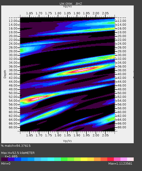
| Arrivals | |
| Ps | 5.8 SECOND |
| PpPs | 21 SECOND |
| PsPs/PpSs | 26 SECOND |

