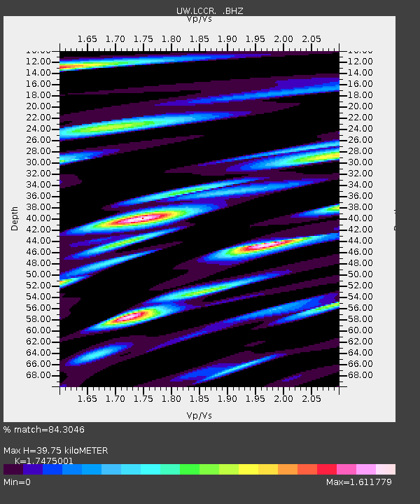
LCCR Mulino, OR, USA - Earthquake Result Viewer

Earthquake location: Near East Coast Of Honshu, Japan
Earthquake latitude/longitude: 37.7/141.4
Earthquake time(UTC): 2011/07/24 (205) 18:51:24 GMT
Earthquake Depth: 35 km
Earthquake Magnitude: 6.3 MB, 5.9 MS, 6.3 MW, 6.3 MW
Earthquake Catalog/Contributor: WHDF/NEIC
Network: UW Pacific Northwest Regional Seismic Network
Station: LCCR Mulino, OR, USA
Lat/Lon: 45.21 N/122.48 W
Elevation: 273 m
Distance: 68.2 deg
Az: 49.197 deg
Baz: 301.894 deg
Ray Param: 0.05639424
Estimated Moho Depth: 39.75 km
Estimated Crust Vp/Vs: 1.75
Assumed Crust Vp: 6.566 km/s
Estimated Crust Vs: 3.757 km/s
Estimated Crust Poisson's Ratio: 0.26
Radial Match: 84.3046 %
Radial Bump: 400
Transverse Match: 85.118256 %
Transverse Bump: 400
SOD ConfigId: 405110
Insert Time: 2011-12-29 06:26:29.248 +0000
GWidth: 2.5
Max Bumps: 400
Tol: 0.001

Signal To Noise

ChannelStoNSTALTA
UW:LCCR: :BHZ:20110724T19:01:50.650005Z3.62463976.333406E-71.7473202E-7
UW:LCCR: :BHN:20110724T19:01:50.650005Z1.39138943.3337318E-72.3959734E-7
UW:LCCR: :BHE:20110724T19:01:50.650005Z1.21306793.5279342E-72.9082744E-7
Arrivals
Ps4.7 SECOND
PpPs16 SECOND
PsPs/PpSs21 SECOND