You are here: Home > Network List > UW - Pacific Northwest Regional Seismic Network Stations List
> Station MRBL Marblemount, WA, USA > Earthquake Result Viewer
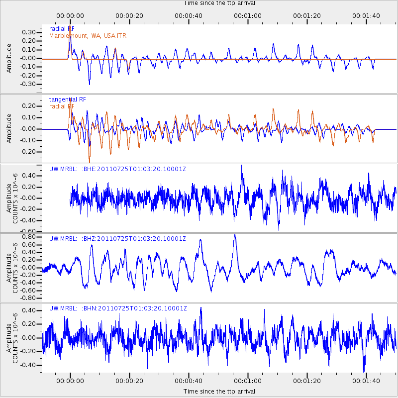
MRBL Marblemount, WA, USA - Earthquake Result Viewer
*The percent match for this event was below the threshold and hence no stack was calculated.
| Earthquake location: |
New Ireland Region, P.N.G. |
| Earthquake latitude/longitude: |
-3.2/150.6 |
| Earthquake time(UTC): |
2011/07/25 (206) 00:50:47 GMT |
| Earthquake Depth: |
10 km |
| Earthquake Magnitude: |
5.9 MB, 6.3 MS, 6.4 MW, 6.3 MW |
| Earthquake Catalog/Contributor: |
WHDF/NEIC |
|
| Network: |
UW Pacific Northwest Regional Seismic Network |
| Station: |
MRBL Marblemount, WA, USA |
| Lat/Lon: |
48.52 N/121.48 W |
| Elevation: |
75 m |
|
| Distance: |
91.0 deg |
| Az: |
41.646 deg |
| Baz: |
266.334 deg |
| Ray Param: |
$rayparam |
*The percent match for this event was below the threshold and hence was not used in the summary stack. |
|
| Radial Match: |
77.20312 % |
| Radial Bump: |
400 |
| Transverse Match: |
54.252716 % |
| Transverse Bump: |
400 |
| SOD ConfigId: |
405110 |
| Insert Time: |
2011-12-29 06:38:51.099 +0000 |
| GWidth: |
2.5 |
| Max Bumps: |
400 |
| Tol: |
0.001 |
|
Signal To Noise
| Channel | StoN | STA | LTA |
| UW:MRBL: :BHZ:20110725T01:03:20.10001Z | 4.0059843 | 2.245438E-7 | 5.605209E-8 |
| UW:MRBL: :BHN:20110725T01:03:20.10001Z | 0.95670736 | 9.573546E-8 | 1.0006765E-7 |
| UW:MRBL: :BHE:20110725T01:03:20.10001Z | 1.046365 | 1.09279455E-7 | 1.0443722E-7 |
| Arrivals |
| Ps | |
| PpPs | |
| PsPs/PpSs | |


