TIP Timpagrande, Italy - Earthquake Result Viewer
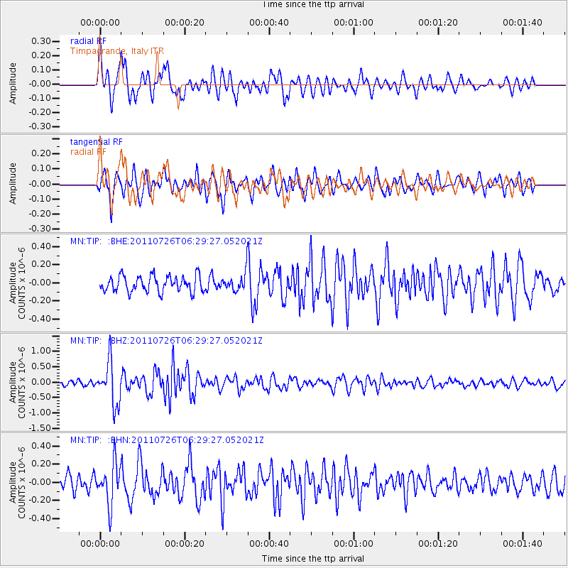
Earthquake location: Off East Coast Of Kamchatka
Earthquake latitude/longitude: 53.0/159.8
Earthquake time(UTC): 2011/07/26 (207) 06:17:37 GMT
Earthquake Depth: 33 km
Earthquake Magnitude: 5.6 MW, 5.1 MS, 5.4 MB, 5.4 MW
Earthquake Catalog/Contributor: WHDF/NEIC
Network: MN MEDNET Project
Station: TIP Timpagrande, Italy
Lat/Lon: 39.18 N/16.76 E
Elevation: 789 m
Distance: 82.8 deg
Az: 331.894 deg
Baz: 21.495 deg
Ray Param: 0.046609964
Estimated Moho Depth: 29.0 km
Estimated Crust Vp/Vs: 2.05
Assumed Crust Vp: 6.1 km/s
Estimated Crust Vs: 2.983 km/s
Estimated Crust Poisson's Ratio: 0.34
Radial Match: 82.428604 %
Radial Bump: 400
Transverse Match: 78.47402 %
Transverse Bump: 400
SOD ConfigId: 405110
Insert Time: 2011-12-29 07:03:17.368 +0000
GWidth: 2.5
Max Bumps: 400
Tol: 0.001

Signal To Noise

ChannelStoNSTALTA
MN:TIP: :BHZ:20110726T06:29:27.052021Z8.661247.1078114E-78.20646E-8
MN:TIP: :BHN:20110726T06:29:27.052021Z2.7627582.3337005E-78.446996E-8
MN:TIP: :BHE:20110726T06:29:27.052021Z1.19643991.0439492E-78.7254634E-8
Arrivals
Ps5.1 SECOND
PpPs14 SECOND
PsPs/PpSs19 SECOND