You are here: Home > Network List > TA - USArray Transportable Network (new EarthScope stations) Stations List
> Station F29A Eureka, SD, USA > Earthquake Result Viewer
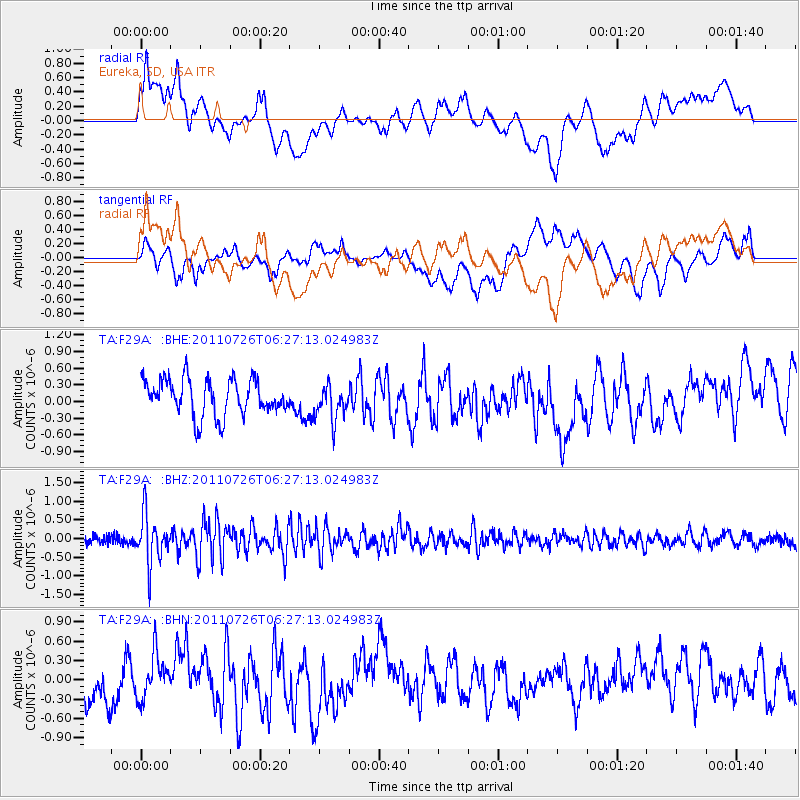
F29A Eureka, SD, USA - Earthquake Result Viewer
*The percent match for this event was below the threshold and hence no stack was calculated.
| Earthquake location: |
Off East Coast Of Kamchatka |
| Earthquake latitude/longitude: |
53.0/159.8 |
| Earthquake time(UTC): |
2011/07/26 (207) 06:17:37 GMT |
| Earthquake Depth: |
33 km |
| Earthquake Magnitude: |
5.6 MW, 5.1 MS, 5.4 MB, 5.4 MW |
| Earthquake Catalog/Contributor: |
WHDF/NEIC |
|
| Network: |
TA USArray Transportable Network (new EarthScope stations) |
| Station: |
F29A Eureka, SD, USA |
| Lat/Lon: |
45.83 N/99.83 W |
| Elevation: |
575 m |
|
| Distance: |
60.4 deg |
| Az: |
52.246 deg |
| Baz: |
316.871 deg |
| Ray Param: |
$rayparam |
*The percent match for this event was below the threshold and hence was not used in the summary stack. |
|
| Radial Match: |
58.908806 % |
| Radial Bump: |
400 |
| Transverse Match: |
53.612923 % |
| Transverse Bump: |
400 |
| SOD ConfigId: |
405110 |
| Insert Time: |
2011-12-29 07:08:00.895 +0000 |
| GWidth: |
2.5 |
| Max Bumps: |
400 |
| Tol: |
0.001 |
|
Signal To Noise
| Channel | StoN | STA | LTA |
| TA:F29A: :BHZ:20110726T06:27:13.024983Z | 5.78814 | 6.454267E-7 | 1.11508484E-7 |
| TA:F29A: :BHN:20110726T06:27:13.024983Z | 0.86780643 | 3.4733952E-7 | 4.0025E-7 |
| TA:F29A: :BHE:20110726T06:27:13.024983Z | 0.99809986 | 3.2441676E-7 | 3.2503436E-7 |
| Arrivals |
| Ps | |
| PpPs | |
| PsPs/PpSs | |


