You are here: Home > Network List > TA - USArray Transportable Network (new EarthScope stations) Stations List
> Station 338A Crockett, TX, USA > Earthquake Result Viewer
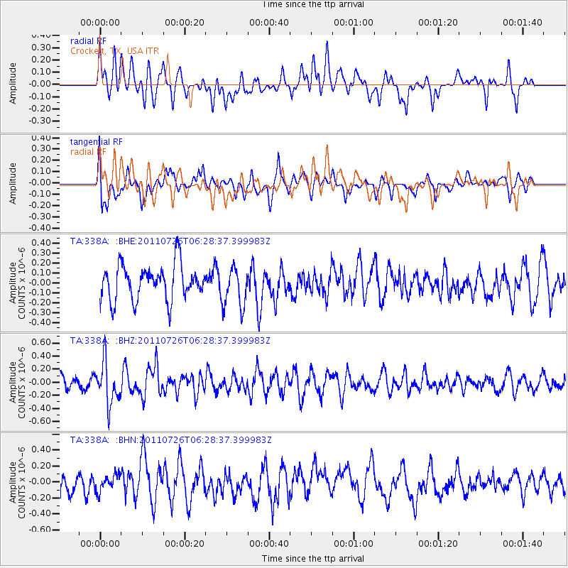
338A Crockett, TX, USA - Earthquake Result Viewer
*The percent match for this event was below the threshold and hence no stack was calculated.
| Earthquake location: |
Off East Coast Of Kamchatka |
| Earthquake latitude/longitude: |
53.0/159.8 |
| Earthquake time(UTC): |
2011/07/26 (207) 06:17:37 GMT |
| Earthquake Depth: |
33 km |
| Earthquake Magnitude: |
5.6 MW, 5.1 MS, 5.4 MB, 5.4 MW |
| Earthquake Catalog/Contributor: |
WHDF/NEIC |
|
| Network: |
TA USArray Transportable Network (new EarthScope stations) |
| Station: |
338A Crockett, TX, USA |
| Lat/Lon: |
31.36 N/95.31 W |
| Elevation: |
137 m |
|
| Distance: |
73.8 deg |
| Az: |
59.437 deg |
| Baz: |
322.521 deg |
| Ray Param: |
$rayparam |
*The percent match for this event was below the threshold and hence was not used in the summary stack. |
|
| Radial Match: |
51.252167 % |
| Radial Bump: |
400 |
| Transverse Match: |
45.4257 % |
| Transverse Bump: |
400 |
| SOD ConfigId: |
405110 |
| Insert Time: |
2011-12-29 07:14:05.040 +0000 |
| GWidth: |
2.5 |
| Max Bumps: |
400 |
| Tol: |
0.001 |
|
Signal To Noise
| Channel | StoN | STA | LTA |
| TA:338A: :BHZ:20110726T06:28:37.399983Z | 2.4711645 | 3.2573803E-7 | 1.318156E-7 |
| TA:338A: :BHN:20110726T06:28:37.399983Z | 0.88773954 | 1.0386029E-7 | 1.169941E-7 |
| TA:338A: :BHE:20110726T06:28:37.399983Z | 1.1697447 | 2.023928E-7 | 1.7302304E-7 |
| Arrivals |
| Ps | |
| PpPs | |
| PsPs/PpSs | |


