You are here: Home > Network List > TA - USArray Transportable Network (new EarthScope stations) Stations List
> Station E31A Nome, ND, USA > Earthquake Result Viewer
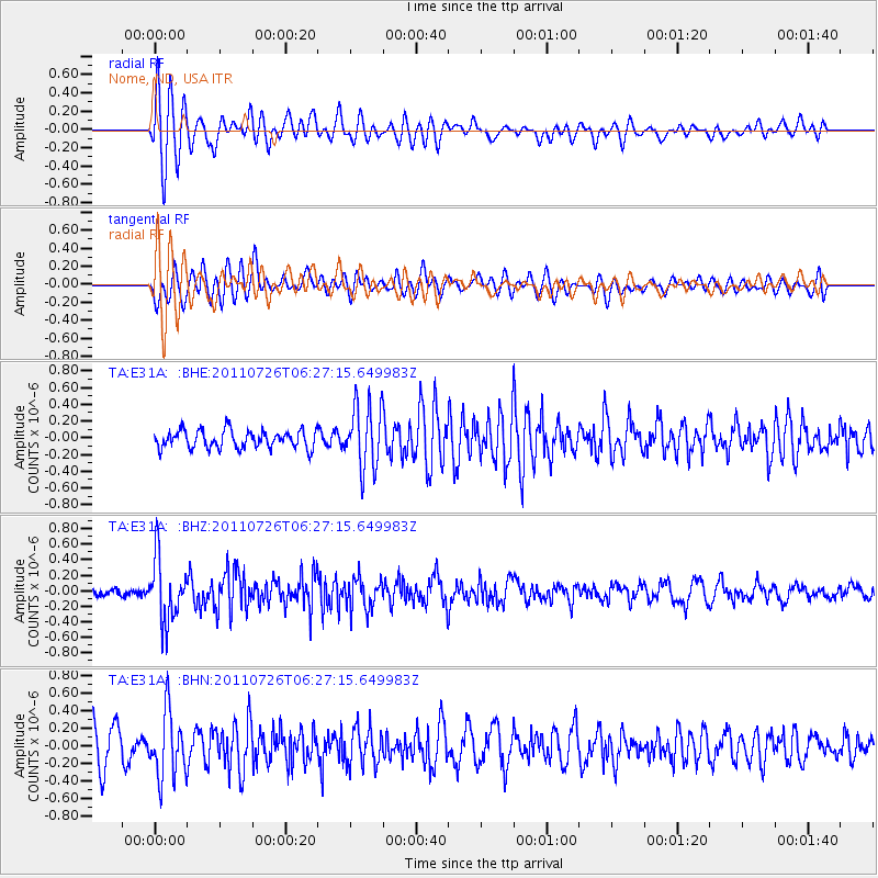
E31A Nome, ND, USA - Earthquake Result Viewer
*The percent match for this event was below the threshold and hence no stack was calculated.
| Earthquake location: |
Off East Coast Of Kamchatka |
| Earthquake latitude/longitude: |
53.0/159.8 |
| Earthquake time(UTC): |
2011/07/26 (207) 06:17:37 GMT |
| Earthquake Depth: |
33 km |
| Earthquake Magnitude: |
5.6 MW, 5.1 MS, 5.4 MB, 5.4 MW |
| Earthquake Catalog/Contributor: |
WHDF/NEIC |
|
| Network: |
TA USArray Transportable Network (new EarthScope stations) |
| Station: |
E31A Nome, ND, USA |
| Lat/Lon: |
46.56 N/97.89 W |
| Elevation: |
427 m |
|
| Distance: |
60.8 deg |
| Az: |
50.547 deg |
| Baz: |
317.433 deg |
| Ray Param: |
$rayparam |
*The percent match for this event was below the threshold and hence was not used in the summary stack. |
|
| Radial Match: |
73.07848 % |
| Radial Bump: |
400 |
| Transverse Match: |
71.202484 % |
| Transverse Bump: |
400 |
| SOD ConfigId: |
405110 |
| Insert Time: |
2011-12-29 07:22:08.215 +0000 |
| GWidth: |
2.5 |
| Max Bumps: |
400 |
| Tol: |
0.001 |
|
Signal To Noise
| Channel | StoN | STA | LTA |
| TA:E31A: :BHZ:20110726T06:27:15.649983Z | 3.7471967 | 4.0152122E-7 | 1.07152424E-7 |
| TA:E31A: :BHN:20110726T06:27:15.649983Z | 2.0925822 | 3.6472636E-7 | 1.7429487E-7 |
| TA:E31A: :BHE:20110726T06:27:15.649983Z | 3.5389795 | 3.7743334E-7 | 1.06650326E-7 |
| Arrivals |
| Ps | |
| PpPs | |
| PsPs/PpSs | |


