You are here: Home > Network List > TA - USArray Transportable Network (new EarthScope stations) Stations List
> Station G32A Webster, SD, USA > Earthquake Result Viewer
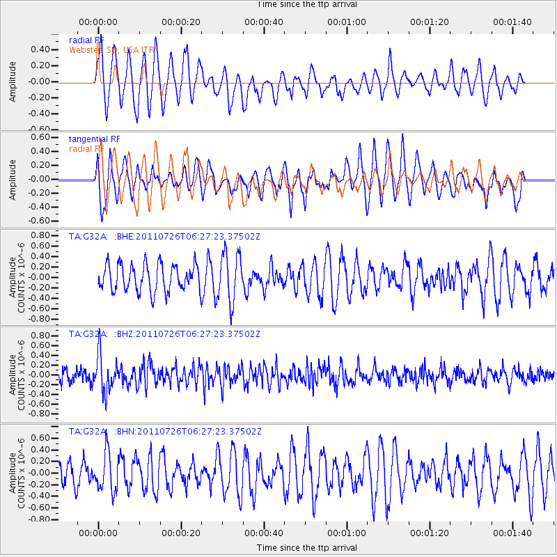
G32A Webster, SD, USA - Earthquake Result Viewer
*The percent match for this event was below the threshold and hence no stack was calculated.
| Earthquake location: |
Off East Coast Of Kamchatka |
| Earthquake latitude/longitude: |
53.0/159.8 |
| Earthquake time(UTC): |
2011/07/26 (207) 06:17:37 GMT |
| Earthquake Depth: |
33 km |
| Earthquake Magnitude: |
5.6 MW, 5.1 MS, 5.4 MB, 5.4 MW |
| Earthquake Catalog/Contributor: |
WHDF/NEIC |
|
| Network: |
TA USArray Transportable Network (new EarthScope stations) |
| Station: |
G32A Webster, SD, USA |
| Lat/Lon: |
45.26 N/97.50 W |
| Elevation: |
566 m |
|
| Distance: |
62.0 deg |
| Az: |
51.316 deg |
| Baz: |
318.079 deg |
| Ray Param: |
$rayparam |
*The percent match for this event was below the threshold and hence was not used in the summary stack. |
|
| Radial Match: |
48.749825 % |
| Radial Bump: |
400 |
| Transverse Match: |
55.419426 % |
| Transverse Bump: |
400 |
| SOD ConfigId: |
405110 |
| Insert Time: |
2011-12-29 07:23:06.431 +0000 |
| GWidth: |
2.5 |
| Max Bumps: |
400 |
| Tol: |
0.001 |
|
Signal To Noise
| Channel | StoN | STA | LTA |
| TA:G32A: :BHZ:20110726T06:27:23.37502Z | 3.8195703 | 3.8362532E-7 | 1.0043678E-7 |
| TA:G32A: :BHN:20110726T06:27:23.37502Z | 0.82817197 | 3.3681366E-7 | 4.0669528E-7 |
| TA:G32A: :BHE:20110726T06:27:23.37502Z | 1.8308882 | 4.683127E-7 | 2.5578444E-7 |
| Arrivals |
| Ps | |
| PpPs | |
| PsPs/PpSs | |


