You are here: Home > Network List > TA - USArray Transportable Network (new EarthScope stations) Stations List
> Station Z41A Richland Creek Farm, El Dorado, AR, USA > Earthquake Result Viewer
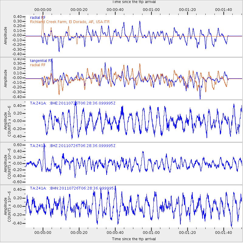
Z41A Richland Creek Farm, El Dorado, AR, USA - Earthquake Result Viewer
*The percent match for this event was below the threshold and hence no stack was calculated.
| Earthquake location: |
Off East Coast Of Kamchatka |
| Earthquake latitude/longitude: |
53.0/159.8 |
| Earthquake time(UTC): |
2011/07/26 (207) 06:17:37 GMT |
| Earthquake Depth: |
33 km |
| Earthquake Magnitude: |
5.6 MW, 5.1 MS, 5.4 MB, 5.4 MW |
| Earthquake Catalog/Contributor: |
WHDF/NEIC |
|
| Network: |
TA USArray Transportable Network (new EarthScope stations) |
| Station: |
Z41A Richland Creek Farm, El Dorado, AR, USA |
| Lat/Lon: |
33.26 N/92.80 W |
| Elevation: |
62 m |
|
| Distance: |
73.5 deg |
| Az: |
56.48 deg |
| Baz: |
323.022 deg |
| Ray Param: |
$rayparam |
*The percent match for this event was below the threshold and hence was not used in the summary stack. |
|
| Radial Match: |
46.136784 % |
| Radial Bump: |
400 |
| Transverse Match: |
41.939102 % |
| Transverse Bump: |
346 |
| SOD ConfigId: |
405110 |
| Insert Time: |
2011-12-29 07:31:38.669 +0000 |
| GWidth: |
2.5 |
| Max Bumps: |
400 |
| Tol: |
0.001 |
|
Signal To Noise
| Channel | StoN | STA | LTA |
| TA:Z41A: :BHZ:20110726T06:28:36.099995Z | 2.7148435 | 2.5563753E-7 | 9.416289E-8 |
| TA:Z41A: :BHN:20110726T06:28:36.099995Z | 0.846426 | 1.251773E-7 | 1.4788924E-7 |
| TA:Z41A: :BHE:20110726T06:28:36.099995Z | 0.80747885 | 1.67297E-7 | 2.0718437E-7 |
| Arrivals |
| Ps | |
| PpPs | |
| PsPs/PpSs | |


