You are here: Home > Network List > AZ - ANZA Regional Network Stations List
> Station SMER AZ.SMER > Earthquake Result Viewer
SMER AZ.SMER - Earthquake Result Viewer
*The percent match for this event was below the threshold and hence no stack was calculated.
| Earthquake location: |
Northern Mid-Atlantic Ridge |
| Earthquake latitude/longitude: |
10.8/-43.4 |
| Earthquake time(UTC): |
2011/07/27 (208) 23:00:30 GMT |
| Earthquake Depth: |
10 km |
| Earthquake Magnitude: |
5.6 MB, 5.6 MS, 6.0 MW, 5.9 MW |
| Earthquake Catalog/Contributor: |
WHDF/NEIC |
|
| Network: |
AZ ANZA Regional Network |
| Station: |
SMER AZ.SMER |
| Lat/Lon: |
33.46 N/117.17 W |
| Elevation: |
355 m |
|
| Distance: |
70.6 deg |
| Az: |
301.695 deg |
| Baz: |
89.694 deg |
| Ray Param: |
$rayparam |
*The percent match for this event was below the threshold and hence was not used in the summary stack. |
|
| Radial Match: |
18.232023 % |
| Radial Bump: |
400 |
| Transverse Match: |
25.730515 % |
| Transverse Bump: |
400 |
| SOD ConfigId: |
405110 |
| Insert Time: |
2011-12-29 08:08:28.518 +0000 |
| GWidth: |
2.5 |
| Max Bumps: |
400 |
| Tol: |
0.001 |
|
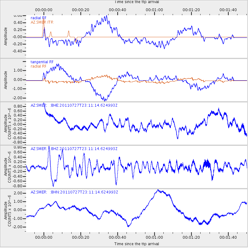
Signal To Noise
| Channel | StoN | STA | LTA |
| AZ:SMER: :BHZ:20110727T23:11:14.624993Z | 4.111939 | 3.7911352E-7 | 9.2198235E-8 |
| AZ:SMER: :BHN:20110727T23:11:14.624993Z | 0.7377074 | 5.079963E-7 | 6.886149E-7 |
| AZ:SMER: :BHE:20110727T23:11:14.624993Z | 0.6435432 | 1.7773705E-7 | 2.7618512E-7 |
| Arrivals |
| Ps | |
| PpPs | |
| PsPs/PpSs | |


