You are here: Home > Network List > BK - Berkeley Digital Seismograph Network Stations List
> Station HUMO Hull Mountain, OR > Earthquake Result Viewer
HUMO Hull Mountain, OR - Earthquake Result Viewer
*The percent match for this event was below the threshold and hence no stack was calculated.
| Earthquake location: |
Northern Mid-Atlantic Ridge |
| Earthquake latitude/longitude: |
10.8/-43.4 |
| Earthquake time(UTC): |
2011/07/27 (208) 23:00:30 GMT |
| Earthquake Depth: |
10 km |
| Earthquake Magnitude: |
5.6 MB, 5.6 MS, 6.0 MW, 5.9 MW |
| Earthquake Catalog/Contributor: |
WHDF/NEIC |
|
| Network: |
BK Berkeley Digital Seismograph Network |
| Station: |
HUMO Hull Mountain, OR |
| Lat/Lon: |
42.61 N/122.96 W |
| Elevation: |
555 m |
|
| Distance: |
75.1 deg |
| Az: |
311.298 deg |
| Baz: |
88.968 deg |
| Ray Param: |
$rayparam |
*The percent match for this event was below the threshold and hence was not used in the summary stack. |
|
| Radial Match: |
63.489025 % |
| Radial Bump: |
400 |
| Transverse Match: |
50.215004 % |
| Transverse Bump: |
400 |
| SOD ConfigId: |
405110 |
| Insert Time: |
2011-12-29 08:09:10.704 +0000 |
| GWidth: |
2.5 |
| Max Bumps: |
400 |
| Tol: |
0.001 |
|
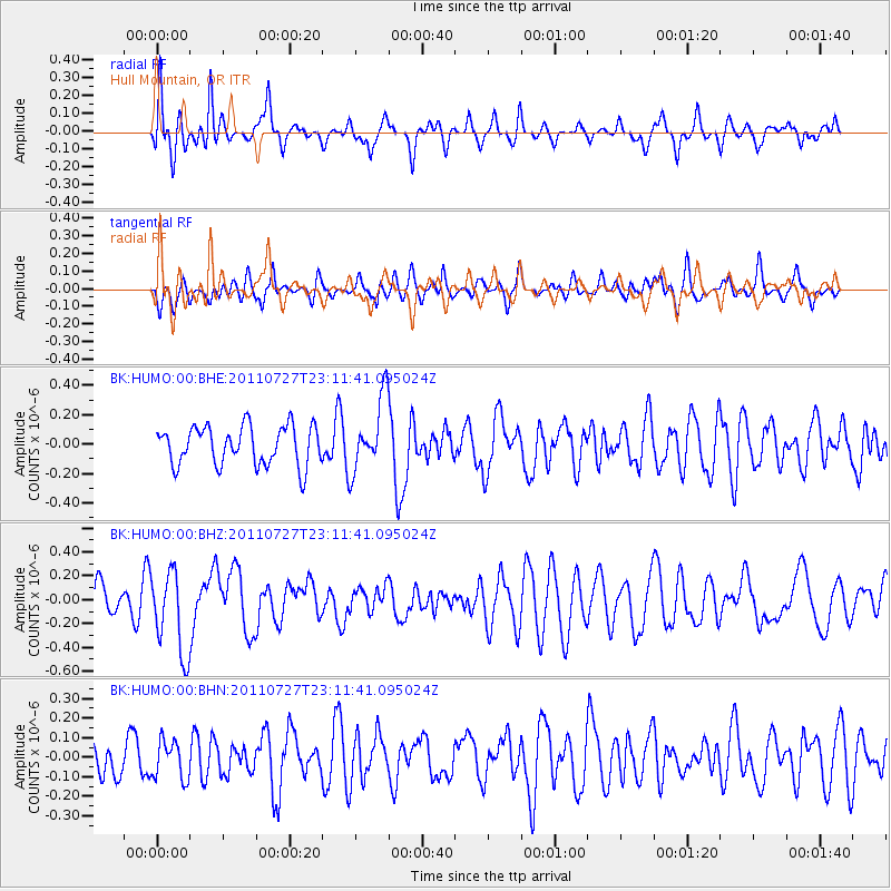
Signal To Noise
| Channel | StoN | STA | LTA |
| BK:HUMO:00:BHZ:20110727T23:11:41.095024Z | 2.3115423 | 3.4735365E-7 | 1.5026923E-7 |
| BK:HUMO:00:BHN:20110727T23:11:41.095024Z | 0.92260444 | 9.774851E-8 | 1.0594845E-7 |
| BK:HUMO:00:BHE:20110727T23:11:41.095024Z | 1.8432486 | 2.4396022E-7 | 1.323534E-7 |
| Arrivals |
| Ps | |
| PpPs | |
| PsPs/PpSs | |


