You are here: Home > Network List > CI - Caltech Regional Seismic Network Stations List
> Station SHO Shoshone, CA, USA > Earthquake Result Viewer
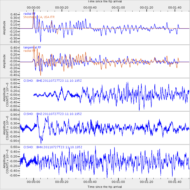
SHO Shoshone, CA, USA - Earthquake Result Viewer
*The percent match for this event was below the threshold and hence no stack was calculated.
| Earthquake location: |
Northern Mid-Atlantic Ridge |
| Earthquake latitude/longitude: |
10.8/-43.4 |
| Earthquake time(UTC): |
2011/07/27 (208) 23:00:30 GMT |
| Earthquake Depth: |
10 km |
| Earthquake Magnitude: |
5.6 MB, 5.6 MS, 6.0 MW, 5.9 MW |
| Earthquake Catalog/Contributor: |
WHDF/NEIC |
|
| Network: |
CI Caltech Regional Seismic Network |
| Station: |
SHO Shoshone, CA, USA |
| Lat/Lon: |
35.90 N/116.28 W |
| Elevation: |
451 m |
|
| Distance: |
69.9 deg |
| Az: |
304.288 deg |
| Baz: |
91.077 deg |
| Ray Param: |
$rayparam |
*The percent match for this event was below the threshold and hence was not used in the summary stack. |
|
| Radial Match: |
68.660805 % |
| Radial Bump: |
400 |
| Transverse Match: |
61.52212 % |
| Transverse Bump: |
400 |
| SOD ConfigId: |
405110 |
| Insert Time: |
2011-12-29 08:11:13.355 +0000 |
| GWidth: |
2.5 |
| Max Bumps: |
400 |
| Tol: |
0.001 |
|
Signal To Noise
| Channel | StoN | STA | LTA |
| CI:SHO: :BHZ:20110727T23:11:10.195Z | 3.9234235 | 3.6731578E-7 | 9.362124E-8 |
| CI:SHO: :BHN:20110727T23:11:10.195Z | 1.3078216 | 1.2581606E-7 | 9.620277E-8 |
| CI:SHO: :BHE:20110727T23:11:10.195Z | 1.3692278 | 1.6781436E-7 | 1.2256133E-7 |
| Arrivals |
| Ps | |
| PpPs | |
| PsPs/PpSs | |


