LUPA Lehigh University, PA - Earthquake Result Viewer
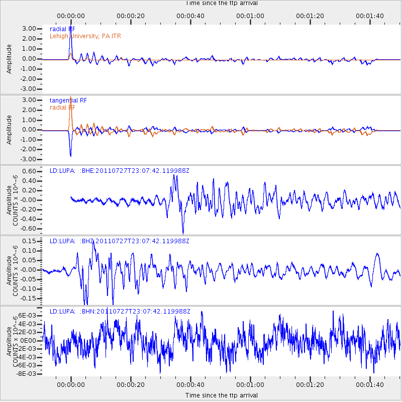
Earthquake location: Northern Mid-Atlantic Ridge
Earthquake latitude/longitude: 10.8/-43.4
Earthquake time(UTC): 2011/07/27 (208) 23:00:30 GMT
Earthquake Depth: 10 km
Earthquake Magnitude: 5.6 MB, 5.6 MS, 6.0 MW, 5.9 MW
Earthquake Catalog/Contributor: WHDF/NEIC
Network: LD Lamont-Doherty Cooperative Seismographic Network
Station: LUPA Lehigh University, PA
Lat/Lon: 40.60 N/75.37 W
Elevation: 236 m
Distance: 40.9 deg
Az: 322.026 deg
Baz: 127.445 deg
Ray Param: 0.07409653
Estimated Moho Depth: 47.0 km
Estimated Crust Vp/Vs: 1.98
Assumed Crust Vp: 6.283 km/s
Estimated Crust Vs: 3.181 km/s
Estimated Crust Poisson's Ratio: 0.33
Radial Match: 88.22375 %
Radial Bump: 369
Transverse Match: 88.32296 %
Transverse Bump: 354
SOD ConfigId: 405110
Insert Time: 2011-12-29 08:20:38.604 +0000
GWidth: 2.5
Max Bumps: 400
Tol: 0.001

Signal To Noise

ChannelStoNSTALTA
LD:LUPA: :BHZ:20110727T23:07:42.119988Z9.2711526.250594E-86.7419825E-9
LD:LUPA: :BHN:20110727T23:07:42.119988Z0.76696221.763941E-92.2999063E-9
LD:LUPA: :BHE:20110727T23:07:42.119988Z4.9597642.0087505E-74.050093E-8
Arrivals
Ps7.7 SECOND
PpPs21 SECOND
PsPs/PpSs29 SECOND