PANJ Princeton, NJ - Earthquake Result Viewer
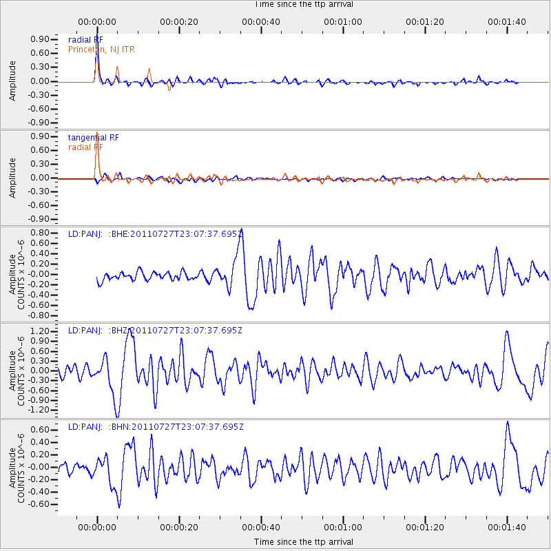
Earthquake location: Northern Mid-Atlantic Ridge
Earthquake latitude/longitude: 10.8/-43.4
Earthquake time(UTC): 2011/07/27 (208) 23:00:30 GMT
Earthquake Depth: 10 km
Earthquake Magnitude: 5.6 MB, 5.6 MS, 6.0 MW, 5.9 MW
Earthquake Catalog/Contributor: WHDF/NEIC
Network: LD Lamont-Doherty Cooperative Seismographic Network
Station: PANJ Princeton, NJ
Lat/Lon: 40.38 N/74.70 W
Elevation: 100 m
Distance: 40.4 deg
Az: 322.237 deg
Baz: 128.037 deg
Ray Param: 0.07441757
Estimated Moho Depth: 26.0 km
Estimated Crust Vp/Vs: 2.09
Assumed Crust Vp: 6.283 km/s
Estimated Crust Vs: 3.01 km/s
Estimated Crust Poisson's Ratio: 0.35
Radial Match: 88.694435 %
Radial Bump: 261
Transverse Match: 63.56803 %
Transverse Bump: 400
SOD ConfigId: 405110
Insert Time: 2011-12-29 08:21:23.548 +0000
GWidth: 2.5
Max Bumps: 400
Tol: 0.001

Signal To Noise

ChannelStoNSTALTA
LD:PANJ: :BHZ:20110727T23:07:37.695Z3.92344555.786203E-71.4747759E-7
LD:PANJ: :BHN:20110727T23:07:37.695Z2.76050522.2128503E-78.0161065E-8
LD:PANJ: :BHE:20110727T23:07:37.695Z4.01769832.9921566E-77.44744E-8
Arrivals
Ps4.8 SECOND
PpPs12 SECOND
PsPs/PpSs17 SECOND