UTMT Martin, TN - Earthquake Result Viewer
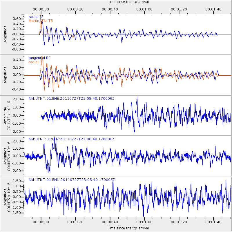
Earthquake location: Northern Mid-Atlantic Ridge
Earthquake latitude/longitude: 10.8/-43.4
Earthquake time(UTC): 2011/07/27 (208) 23:00:30 GMT
Earthquake Depth: 10 km
Earthquake Magnitude: 5.6 MB, 5.6 MS, 6.0 MW, 5.9 MW
Earthquake Catalog/Contributor: WHDF/NEIC
Network: NM Cooperative New Madrid Seismic Network
Station: UTMT Martin, TN
Lat/Lon: 36.35 N/88.86 W
Elevation: 110 m
Distance: 48.2 deg
Az: 309.499 deg
Baz: 110.098 deg
Ray Param: 0.06949204
Estimated Moho Depth: 10.0 km
Estimated Crust Vp/Vs: 1.60
Assumed Crust Vp: 6.444 km/s
Estimated Crust Vs: 4.021 km/s
Estimated Crust Poisson's Ratio: 0.18
Radial Match: 84.72524 %
Radial Bump: 400
Transverse Match: 65.420334 %
Transverse Bump: 400
SOD ConfigId: 405110
Insert Time: 2011-12-29 08:24:40.153 +0000
GWidth: 2.5
Max Bumps: 400
Tol: 0.001

Signal To Noise

ChannelStoNSTALTA
NM:UTMT:01:BHZ:20110727T23:08:40.170006Z4.25125039.074523E-72.1345541E-7
NM:UTMT:01:BHN:20110727T23:08:40.170006Z1.13595863.6532452E-73.2160025E-7
NM:UTMT:01:BHE:20110727T23:08:40.170006Z1.74608045.275189E-73.0211606E-7
Arrivals
Ps1.0 SECOND
PpPs3.8 SECOND
PsPs/PpSs4.8 SECOND