You are here: Home > Network List > TA - USArray Transportable Network (new EarthScope stations) Stations List
> Station J34A George, IA, USA > Earthquake Result Viewer
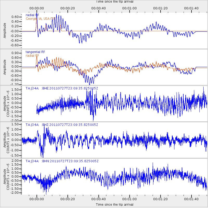
J34A George, IA, USA - Earthquake Result Viewer
*The percent match for this event was below the threshold and hence no stack was calculated.
| Earthquake location: |
Northern Mid-Atlantic Ridge |
| Earthquake latitude/longitude: |
10.8/-43.4 |
| Earthquake time(UTC): |
2011/07/27 (208) 23:00:30 GMT |
| Earthquake Depth: |
10 km |
| Earthquake Magnitude: |
5.6 MB, 5.6 MS, 6.0 MW, 5.9 MW |
| Earthquake Catalog/Contributor: |
WHDF/NEIC |
|
| Network: |
TA USArray Transportable Network (new EarthScope stations) |
| Station: |
J34A George, IA, USA |
| Lat/Lon: |
43.28 N/95.96 W |
| Elevation: |
432 m |
|
| Distance: |
55.7 deg |
| Az: |
315.428 deg |
| Baz: |
109.224 deg |
| Ray Param: |
$rayparam |
*The percent match for this event was below the threshold and hence was not used in the summary stack. |
|
| Radial Match: |
52.432613 % |
| Radial Bump: |
400 |
| Transverse Match: |
17.727814 % |
| Transverse Bump: |
400 |
| SOD ConfigId: |
405110 |
| Insert Time: |
2011-12-29 09:08:31.083 +0000 |
| GWidth: |
2.5 |
| Max Bumps: |
400 |
| Tol: |
0.001 |
|
Signal To Noise
| Channel | StoN | STA | LTA |
| TA:J34A: :BHZ:20110727T23:09:35.825005Z | 4.3946877 | 7.1491417E-7 | 1.6267688E-7 |
| TA:J34A: :BHN:20110727T23:09:35.825005Z | 1.6651922 | 5.0348405E-7 | 3.023579E-7 |
| TA:J34A: :BHE:20110727T23:09:35.825005Z | 1.7766603 | 6.769713E-7 | 3.8103587E-7 |
| Arrivals |
| Ps | |
| PpPs | |
| PsPs/PpSs | |


