You are here: Home > Network List > TA - USArray Transportable Network (new EarthScope stations) Stations List
> Station O03D Paynes Creek, CA, USA > Earthquake Result Viewer
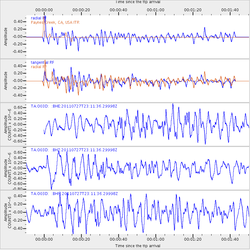
O03D Paynes Creek, CA, USA - Earthquake Result Viewer
*The percent match for this event was below the threshold and hence no stack was calculated.
| Earthquake location: |
Northern Mid-Atlantic Ridge |
| Earthquake latitude/longitude: |
10.8/-43.4 |
| Earthquake time(UTC): |
2011/07/27 (208) 23:00:30 GMT |
| Earthquake Depth: |
10 km |
| Earthquake Magnitude: |
5.6 MB, 5.6 MS, 6.0 MW, 5.9 MW |
| Earthquake Catalog/Contributor: |
WHDF/NEIC |
|
| Network: |
TA USArray Transportable Network (new EarthScope stations) |
| Station: |
O03D Paynes Creek, CA, USA |
| Lat/Lon: |
40.29 N/121.80 W |
| Elevation: |
968 m |
|
| Distance: |
74.3 deg |
| Az: |
308.887 deg |
| Baz: |
89.093 deg |
| Ray Param: |
$rayparam |
*The percent match for this event was below the threshold and hence was not used in the summary stack. |
|
| Radial Match: |
59.733624 % |
| Radial Bump: |
400 |
| Transverse Match: |
68.598785 % |
| Transverse Bump: |
400 |
| SOD ConfigId: |
405110 |
| Insert Time: |
2011-12-29 09:09:03.263 +0000 |
| GWidth: |
2.5 |
| Max Bumps: |
400 |
| Tol: |
0.001 |
|
Signal To Noise
| Channel | StoN | STA | LTA |
| TA:O03D: :BHZ:20110727T23:11:36.29998Z | 2.656098 | 3.550277E-7 | 1.3366515E-7 |
| TA:O03D: :BHN:20110727T23:11:36.29998Z | 0.53145266 | 8.241941E-8 | 1.5508327E-7 |
| TA:O03D: :BHE:20110727T23:11:36.29998Z | 0.9177744 | 1.8801256E-7 | 2.0485706E-7 |
| Arrivals |
| Ps | |
| PpPs | |
| PsPs/PpSs | |


