You are here: Home > Network List > GS - US Geological Survey Networks Stations List
> Station DEC09 Decatur Surface Seismic Site, Decatur, IL, USA > Earthquake Result Viewer
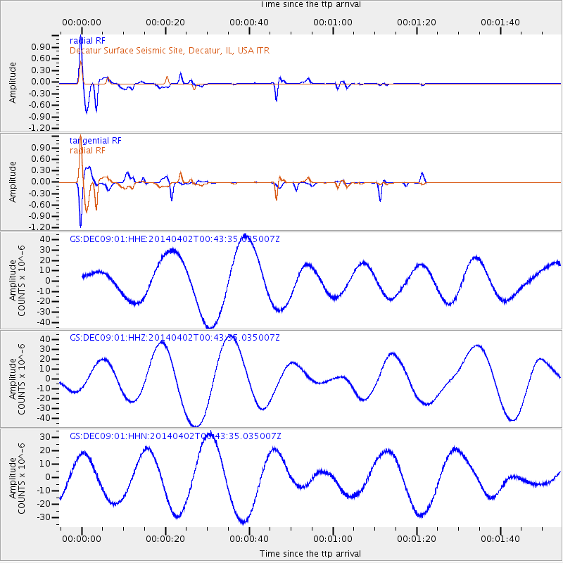
DEC09 Decatur Surface Seismic Site, Decatur, IL, USA - Earthquake Result Viewer
*The percent match for this event was below the threshold and hence no stack was calculated.
| Earthquake location: |
Near Coast Of Northern Chile |
| Earthquake latitude/longitude: |
-20.2/-70.7 |
| Earthquake time(UTC): |
2014/04/02 (092) 00:33:45 GMT |
| Earthquake Depth: |
13 km |
| Earthquake Magnitude: |
5.5 MB |
| Earthquake Catalog/Contributor: |
NEIC PDE/NEIC COMCAT |
|
| Network: |
GS US Geological Survey Networks |
| Station: |
DEC09 Decatur Surface Seismic Site, Decatur, IL, USA |
| Lat/Lon: |
39.87 N/88.92 W |
| Elevation: |
207 m |
|
| Distance: |
62.2 deg |
| Az: |
344.2 deg |
| Baz: |
160.597 deg |
| Ray Param: |
$rayparam |
*The percent match for this event was below the threshold and hence was not used in the summary stack. |
|
| Radial Match: |
76.53726 % |
| Radial Bump: |
400 |
| Transverse Match: |
75.56024 % |
| Transverse Bump: |
400 |
| SOD ConfigId: |
3390531 |
| Insert Time: |
2019-04-11 00:28:55.141 +0000 |
| GWidth: |
2.5 |
| Max Bumps: |
400 |
| Tol: |
0.001 |
|
Signal To Noise
| Channel | StoN | STA | LTA |
| GS:DEC09:01:HHZ:20140402T00:43:35.035007Z | 1.3734552 | 1.1983849E-5 | 8.725329E-6 |
| GS:DEC09:01:HHN:20140402T00:43:35.035007Z | 1.4383824 | 1.4772566E-5 | 1.0270263E-5 |
| GS:DEC09:01:HHE:20140402T00:43:35.035007Z | 2.4729276 | 3.9605577E-5 | 1.6015665E-5 |
| Arrivals |
| Ps | |
| PpPs | |
| PsPs/PpSs | |


