You are here: Home > Network List > CI - Caltech Regional Seismic Network Stations List
> Station RCT Rector, Visalia, CA, USA > Earthquake Result Viewer
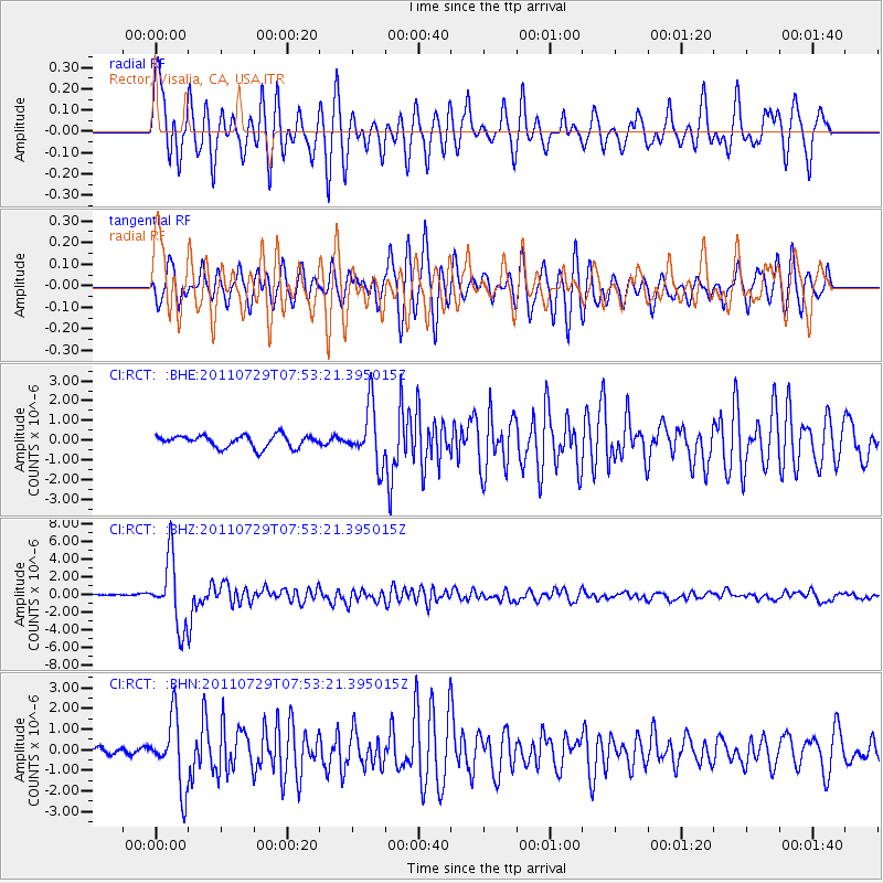
RCT Rector, Visalia, CA, USA - Earthquake Result Viewer
*The percent match for this event was below the threshold and hence no stack was calculated.
| Earthquake location: |
South Of Fiji Islands |
| Earthquake latitude/longitude: |
-23.8/179.8 |
| Earthquake time(UTC): |
2011/07/29 (210) 07:42:22 GMT |
| Earthquake Depth: |
523 km |
| Earthquake Magnitude: |
6.2 MB, 6.7 MW, 6.7 MW |
| Earthquake Catalog/Contributor: |
WHDF/NEIC |
|
| Network: |
CI Caltech Regional Seismic Network |
| Station: |
RCT Rector, Visalia, CA, USA |
| Lat/Lon: |
36.31 N/119.24 W |
| Elevation: |
107 m |
|
| Distance: |
83.0 deg |
| Az: |
45.383 deg |
| Baz: |
233.828 deg |
| Ray Param: |
$rayparam |
*The percent match for this event was below the threshold and hence was not used in the summary stack. |
|
| Radial Match: |
77.84105 % |
| Radial Bump: |
400 |
| Transverse Match: |
82.175735 % |
| Transverse Bump: |
400 |
| SOD ConfigId: |
405110 |
| Insert Time: |
2011-12-29 09:56:05.632 +0000 |
| GWidth: |
2.5 |
| Max Bumps: |
400 |
| Tol: |
0.001 |
|
Signal To Noise
| Channel | StoN | STA | LTA |
| CI:RCT: :BHZ:20110729T07:53:21.395015Z | 33.65189 | 3.832702E-6 | 1.1389263E-7 |
| CI:RCT: :BHN:20110729T07:53:21.395015Z | 6.764628 | 1.6630461E-6 | 2.4584443E-7 |
| CI:RCT: :BHE:20110729T07:53:21.395015Z | 4.6340346 | 1.4283853E-6 | 3.0823793E-7 |
| Arrivals |
| Ps | |
| PpPs | |
| PsPs/PpSs | |


