You are here: Home > Network List > CI - Caltech Regional Seismic Network Stations List
> Station MUR Murrieta > Earthquake Result Viewer
MUR Murrieta - Earthquake Result Viewer

| Earthquake location: |
South Of Fiji Islands |
| Earthquake latitude/longitude: |
-23.8/179.8 |
| Earthquake time(UTC): |
2011/07/29 (210) 07:42:22 GMT |
| Earthquake Depth: |
523 km |
| Earthquake Magnitude: |
6.2 MB, 6.7 MW, 6.7 MW |
| Earthquake Catalog/Contributor: |
WHDF/NEIC |
|
| Network: |
CI Caltech Regional Seismic Network |
| Station: |
MUR Murrieta |
| Lat/Lon: |
33.60 N/117.20 W |
| Elevation: |
562 m |
|
| Distance: |
82.8 deg |
| Az: |
48.582 deg |
| Baz: |
235.394 deg |
| Ray Param: |
0.045135323 |
| Estimated Moho Depth: |
13.0 km |
| Estimated Crust Vp/Vs: |
1.60 |
| Assumed Crust Vp: |
6.264 km/s |
| Estimated Crust Vs: |
3.915 km/s |
| Estimated Crust Poisson's Ratio: |
0.18 |
|
| Radial Match: |
94.13354 % |
| Radial Bump: |
309 |
| Transverse Match: |
81.92954 % |
| Transverse Bump: |
382 |
| SOD ConfigId: |
405110 |
| Insert Time: |
2011-12-29 09:58:18.452 +0000 |
| GWidth: |
2.5 |
| Max Bumps: |
400 |
| Tol: |
0.001 |
|
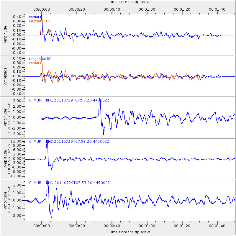
Signal To Noise
| Channel | StoN | STA | LTA |
| CI:MUR: :BHZ:20110729T07:53:20.445002Z | 27.008802 | 4.900324E-6 | 1.8143432E-7 |
| CI:MUR: :BHN:20110729T07:53:20.445002Z | 6.693994 | 1.0400131E-6 | 1.5536511E-7 |
| CI:MUR: :BHE:20110729T07:53:20.445002Z | 11.09881 | 1.3645575E-6 | 1.2294629E-7 |
| Arrivals |
| Ps | 1.3 SECOND |
| PpPs | 5.3 SECOND |
| PsPs/PpSs | 6.5 SECOND |


