You are here: Home > Network List > G - GEOSCOPE Stations List
> Station UNM Unam,Mexico > Earthquake Result Viewer
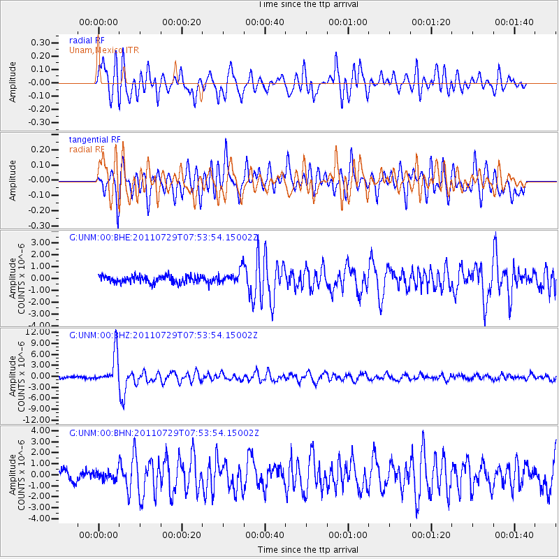
UNM Unam,Mexico - Earthquake Result Viewer
*The percent match for this event was below the threshold and hence no stack was calculated.
| Earthquake location: |
South Of Fiji Islands |
| Earthquake latitude/longitude: |
-23.8/179.8 |
| Earthquake time(UTC): |
2011/07/29 (210) 07:42:22 GMT |
| Earthquake Depth: |
523 km |
| Earthquake Magnitude: |
6.2 MB, 6.7 MW, 6.7 MW |
| Earthquake Catalog/Contributor: |
WHDF/NEIC |
|
| Network: |
G GEOSCOPE |
| Station: |
UNM Unam,Mexico |
| Lat/Lon: |
19.33 N/99.18 W |
| Elevation: |
2280 m |
|
| Distance: |
89.9 deg |
| Az: |
68.885 deg |
| Baz: |
244.816 deg |
| Ray Param: |
$rayparam |
*The percent match for this event was below the threshold and hence was not used in the summary stack. |
|
| Radial Match: |
78.95701 % |
| Radial Bump: |
400 |
| Transverse Match: |
72.56358 % |
| Transverse Bump: |
400 |
| SOD ConfigId: |
405110 |
| Insert Time: |
2011-12-29 09:59:06.900 +0000 |
| GWidth: |
2.5 |
| Max Bumps: |
400 |
| Tol: |
0.001 |
|
Signal To Noise
| Channel | StoN | STA | LTA |
| G:UNM:00:BHZ:20110729T07:53:54.15002Z | 16.981283 | 4.413248E-6 | 2.5988896E-7 |
| G:UNM:00:BHN:20110729T07:53:54.15002Z | 0.86326146 | 4.0013916E-7 | 4.6352025E-7 |
| G:UNM:00:BHE:20110729T07:53:54.15002Z | 2.1110556 | 6.152028E-7 | 2.914195E-7 |
| Arrivals |
| Ps | |
| PpPs | |
| PsPs/PpSs | |


